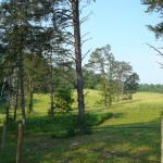
Located in a field below France Cemetery on 391 Spice Hollow Rd., Johnson City, TN and west of the Old Francis Cemetery. Turn off Dry Creek Road onto Jim McNeese Road. Park at the end of the road and cross the fence to the TVA Power Lines running west with a gravel road. Go to the third power structure, look to your right up the hill. A new fence divides the cemetery located between two stands of cedar trees. This area can also be reached traveling from Johnson City on Hwy. 67 (Cherokee Rd.), turn left on Lone Oak Road at the Cherokee Elementary School. Pass the Lone Oak Christian Church. Lone Oak Road changes to Dry Creek Road at the intersection of Sinking Creek Road. Turn right into the new Sea Biscuit subdivision. At the end of the now (May 2008) unnamed street, look to the right at the TVA power lines running west toward Spice Hollow Road. At the end of Mr. Phillip Jones’ driveway, walk between the horse rink and an electric fence on the right. Cross the fence, turn right and walk toward the power structure, which is the third one from Dry Creek Road.
GPS location: 36º16.141N 082º22.312W; Elevation: 1978 ft.
It is estimated that 30 to 40 unmarked graves could be in this area.
Surveyed, transcribed and donated to the Washington County TNGen Web June 2006 by Elaine Scott Cantrell, Robert and Betty Jane Hylton members of the Cemetery Survey Team of Northeast Tennessee.
Copyrighted 2013 by the Cemetery Survey Team of Northeast Tennessee. No part of this work may be copied without written permission from the Cemetery Survey Team.

