Old Jonesborough Cemetery
2014
Click to enlarge picture
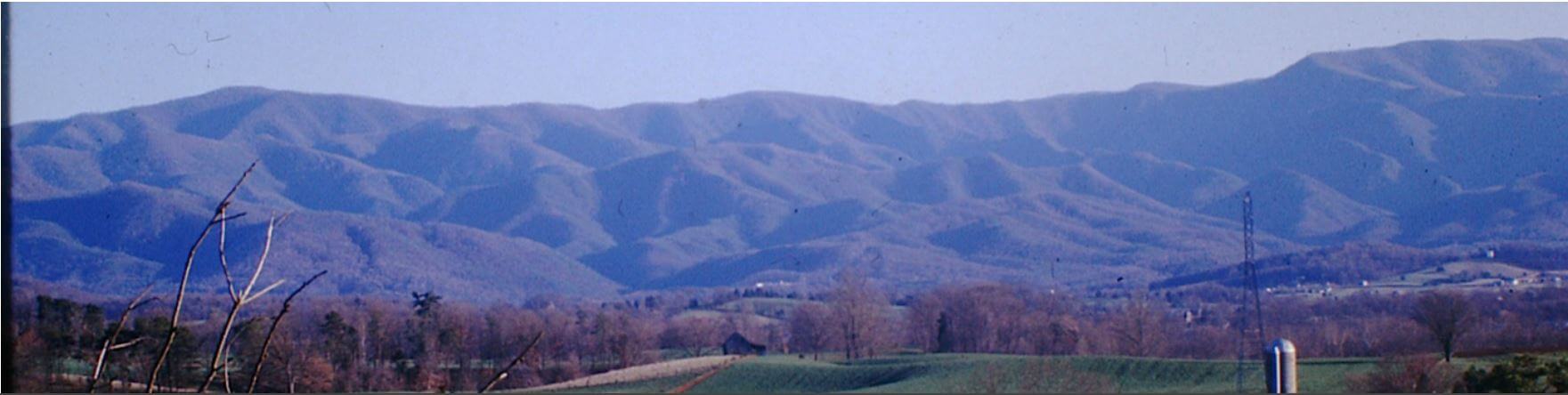
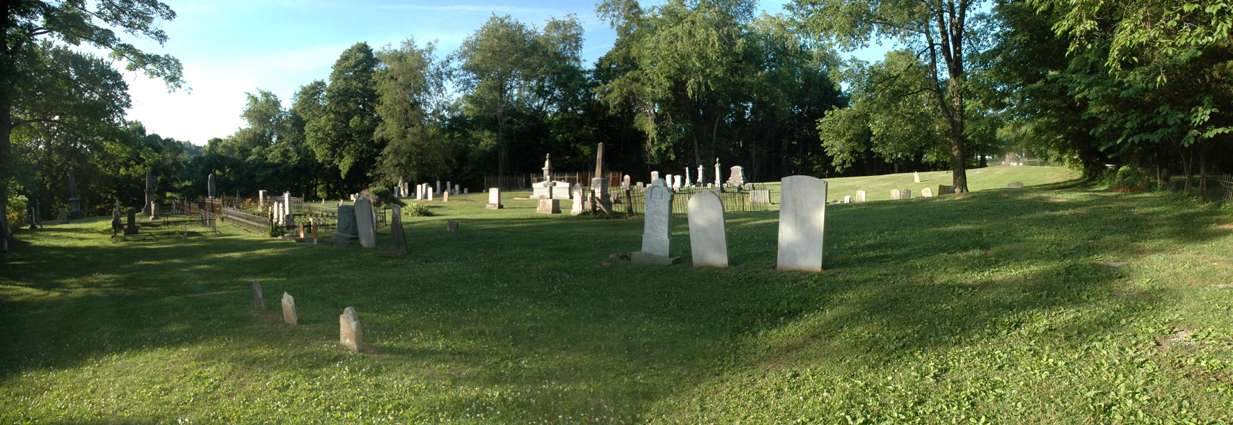
Located next to 233 Main Street, at the top of the hill from the First Baptist Church. It has recently been cleared of brush, tombstones cleaned and reset. The cemetery is owned by the town of Jonesborough and the historical aspect, including the current record keeping of the cemetery is overseen by the Heritage Alliance. Anyone wishing further information regarding this cemetery should contact Heritage Alliance, 212 East Sabin Drive, Jonesborough, Tennessee (423-753-9580).
The cemetery on the property east of Cemetery Lane is know as Evergreen Cemetery/College Hill. It will be posted on a separate web page when the survey is completed.
GPS Location:
| SECT | ROW | GRV | SURNAME | GIVEN | BIRTH DATE | DEATH DATE | NOTES |
|---|---|---|---|---|---|---|---|
| D | 5 | 1 | Aiken | Amanda M. | 20 Apr 1818 | 09 Sep 1857 | Wife of Mathew Aiken |
| D | 5 | 1 | Aiken | Blanche B. | 24 Oct 1789 | 28 Nov 1862 | [Shares marker with Col. Mathew Aiken] |
| D | 5 | 1 | Aiken | Caroline J. | 03 Nov 1828 | 05 May 1861 | [Shares marker with Blanche Aiken Cecil] |
| D | 5 | 1 | Aiken | Margaretta H. | 20 Sep 1831 | 04 Sep 1867 | [Shares marker with Robert S. Aiken] |
| D | 5 | 1 | Aiken | Mathew, Col. | 27 Mar 1775 | 06 Oct 1860 | [Shares marker with Blanche B. Aiken] |
| D | 5 | 1 | Aiken | Robert S. | 15 May 1818 | 01 Dec 1891 | [Shares marker with Margaretta H. Aiken] |
| D | 2 | 4 | Allison | George W. | 13 Sep 1849 | 11 Jan 1929 | [d. 11 Feb 1929] [TDR 5382] |
| D | 6 | 2 | Allison | Malvina Mathews | 30 Apr 1854 | 27 Dec 1915 | [b. 30 Apr 1851] [TDR 535] |
| D | 2 | 2 | Allison | Mary Chester | 1810 | 1887 | |
| D | 2 | 5 | Allison | Robert Guy | 20 Jun 1870 | 08 Aug 1937 | |
| D | 1 | 3 | Allison-Greer | [Family Main Marker] | |||
| H | 4 | 2 | Anderson | Eliza Ryland | 1835 | 1869 | |
| E | 2 | 5 | Anderson | Fannie Deaderick, Mrs. | 09 Jan 1840 | 11 Jan 1909 | [TDR 92962] |
| E | 2 | 4 | Anderson | Frank Deaderick | 14 Jan 1876 | 01 May 1901 | |
| E | 2 | 6 | Anderson | Roy Alexander | 25 Jun 1874 | 27 Feb 1897 | |
| F | 5 | 1 | Armstrong | E.[dward]P.[ackingham]Dr | 26 Feb 1812 | 17 Feb 1894 | [Shares marker with Margaret C. Armstrong] |
| F | 4 | 1 | Armstrong | John A. | 08 May 1916 | Beloved husband of Marie Armstrong | |
| F | 4 | 4 | Armstrong | John N[ichols] | 13 Mar 1881 | 09 May 1950 | [TDR 50-12176] |
| F | 5 | 1 | Armstrong | Margaret C.[ordelia Price] | 15 Jun 1832 | 21 Dec 1892 | [See family monument][Shares marker with Dr. E.P. Armstrong] |
| F | 4 | 2 | Armstrong | Marie | 19 May 1917 | Beloved wife of John A. Armstrong | |
| F | 5 | 2 | Armstrong | Wm. E. S. Pvt 1st Cl | CO. K 3 U.S.V. ENGRS SP. AM WAR | ||
| H | 3 | 1 | Atkinson | Jas. J. Lieut | CO. E. 1 TENN. L.A. | ||
| H | 3 | 2 | Atkinson | Margaret Elizabeth Williams | 09 Jun 1841 | 02 Mar 1921 | Wife of James J. Atkinson |
| A | 1 | 10 | Bachman | Sarah Jane [Cunningham] | 14 Jun 1836 | 26 Jul 1864 | Wife of Rev. N. Bachman |
| L | 2 | 3 | Baxter | Elbridge J.[acob] | 02 Sep 1860 | 26 Feb 1937 | [TDR 3550] |
| L | 2 | 4 | Baxter | Eleanor L.[ampson] | 18 Jul 1864 | 18 Jul 1957 | [TDR 57-18232] |
| L | 2 | 5 | Baxter | Martha Lampson | 22 Apr 1894 | 30 Aug 1990 | |
| K | 1 | 1 | Biers | Elizabeth [Conway Sevier] | 24 Jul 1812 | 19 Oct 1845 | Wife of Charles P. Biers and daughter of John Sevier |
| I | 5 | 2 | Blair | John | 13 Sep 1790 | 22 Mar 1863 | [Shares marker with Mary H. Chester Blair] |
| I | 1 | 2 | Blair | Martha Roe [Cunningham] | 1810 | 21 Dec 1889 | Aged 79 Years |
| I | 6 | 3 | Blair | Mary E.[lder Yearsley] | 11 Mar 1853 | Consort of William K. Blair | |
| I | 5 | 2 | Blair | Mary H. Chester | 12 May 1797 | 11 Nov 1872 | Wife of John Blair [Shares marker with John Blair] |
| I | 4 | 1 | Blair | Nathan Gammon | 01 Jan 1859 | 06 May 1859 | Born at Warm Springs N.C. |
| I | 1 | 1 | Blair | Robert L.[aird] | 1802 | 12 May 1885 | Aged 83 Years |
| I | 5 | 1 | Blair | Sarah Ellen Polk | 11 Apr 1844 | 14 Mar 1849 | Aged 4 Years 11 Months and 3 days |
| K | 6 | 3 | Breazeale | Maria L. | 1830 | 02 Sep 1839 | Aged about 9 yrs |
| H | 2 | 4 | Britton | Belle | 10 Feb 1875 | 03 Dec 1879 | Daughter of T.D. and Moly E. Britton |
| C | 3 | 2 | Brown | Ann Rebecca [McMahon] | 07 Jan 1799 | 06 Feb 1855 | Wife of Enoch Brown. Born in Baltimore, Md. |
| C | 8 | 4 | Brown | Caroline M. | 31 Jun 1850 | Dauhter of James and Margaret Brown Aged 3 yr 3 mo | |
| C | 9 | 1 | Brown | Ellen | 13 Dec 1849 | 26 Mar 1870 | Dau. Of James and Margaret Brown |
| C | 3 | 1 | Brown | Enoch | 1806 | 15 Sep 1878 | |
| C | 8 | 5 | Brown | Geo L. | 18 Aug 1856 | 25 Dec 1897 | |
| C | 8 | 6 | Brown | James | Mar 1802 | 23 Feb 1863 | Masonic emblem |
| M | 8 | 1 | Brown | James Floyd | 04 Sep 1850 | 10 Mar 1859 | Son of J.M. And S.W. Brown |
| C | 8 | 3 | Brown | Joseph N. | 1859 | 1896 | |
| C | 8 | 2 | Brown | Loue | 17 Dec 1856 | 10 Nov 1902 | Wife of G.E. Brown |
| C | 8 | 1 | Brown | Margaret R. | 10 Jun 1901 | 22 Dec 1901 | Daughter of G.E. And Loue Brown |
| K | 11 | 1 | Brown | Rachel G.[eorge] | 1808 | 22 Apr 1835 | Wife of James Brown |
| K | 9 | 1 | Brown | Sarah Ellen | 1843 | 07 Nov 1843 | Daughter of J and M Brown |
| D | 5 | 1 | Brown | Shepherd | 26 Jan 1801 | 02 Feb 1883 | [Shares marker with Fannie E. Mathews] |
| K | 10 | 1 | Brown | Thomas C. | 04 Jun 1833 | 26 Oct 1892 | Masonic emblem |
| A | 3 | 6 | Broyles | Andrew C. | 1831 | 1927 | [Shares marker with Louesa A. E. Hunt] |
| A | 4 | 4 | Broyles | Bettie M.[alinda] | 18 Feb 1850 | 27 Sep 1868 | |
| H | 7 | 1 | Broyles | Jacob F.[ranklin] | 10 Dec 1804 | 02 Nov 1896 | Father and Mother married 13 Dec 1827. [Shares marker with Lucinda A. Broyles] |
| A | 3 | 8 | Broyles | James Henry | 18 May 1861 | 15 Aug 1865 | Son of Andrew and Louiesa A.E. Broyles |
| A | 4 | 5 | Broyles | Jas. V.[an Buren] | 08 Apr 1837 | 21 Dec 1864 | |
| A | 3 | 6 | Broyles | Louesa A.E. Hunt | 1838 | 1906 | Wife of Andrew C. Broyles |
| H | 7 | 1 | Broyles | Lucinda | 14 Sep 1804 | 04 Oct 1891 | [Shares marker with Jacob F. Broyles] |
| M | 1 | 15 | Burson | Charlie Thomas | 21 Feb 1858 | 05 Aug 1859 | Son of Z.L. And Nannie J. Burson |
| M | 3 | 8 | Burson | infant son | 07 May 1873 | 08 May 1873 | Son of Z.L. And Nannie J. Burson |
| M | 1 | 17 | Burson | Little Eddie | 24 Jan 1863 | 20 Feb 1864 | Son of Z.L. and Nannie E. Burson |
| M | 1 | 16 | Burson | Mary Lyle | 02 Oct 1859 | 27 Mar 1862 | Daughter of Z.L. And Nannie J. Burson |
| M | 1 | 13 | Burson | Reason E. | 12 Jul 1852 | 19 Jul 1852 | Infant son of Z.L. And Susan Burson. Aged 7 days |
| M | 3 | 6 | Burson | Robert Sidney | 22 Aug 1868 | 12 May 1870 | Son of Z.L. And Nannie J. Burson |
| B | 7 | 2 | Burson | Roscoe | 28 Nov 1890 | 10 Jul 1891 | Son of E.A. And M.R. Burson |
| M | 3 | 4 | Burson | Sarah A.[lice]W.[hitfield] | 1787 | 12 Oct 1854 | Died in 67th yr |
| M | 3 | 7 | Burson | Sue Dungan | 02 Jun 1872 | 02 Jun 1872 | Infant daughter of Z.L. And Nannie J. Burson |
| M | 1 | 12 | Burson | Susanna [Hale] | 04 Feb 1826 | 17 Jan 1856 | Wife of Z.L. Burson |
| M | 1 | 18 | Burson | Walter Murray | 18 Jan 1867 | 18 May 1869 | Son of Z.L. And Nannie J. Burson |
| M | 3 | 5 | Burson | William Cate | 20 Jun 1855 | 20 May 1869 | Son of Z.L. And Susan Burson |
| M | 1 | 11 | Burson | Z.L. [Zachariah Lyle] | 05 Dec 1817 | 11 Sep 1894 | |
| M | 1 | 19 | Burson | Z.L.B. (initials only) | [Foot Marker - Moved] | ||
| M | 1 | 14 | Burson | Zachariah Whitfield | 04 Jan 1851 | 12 Jul 1851 | Son of Z.L. And Susan Burson |
| G | 5 | 1 | Burton | Minerva Jane [Boyd] | 10 Dec 1831 | 30 Mar 1910 | |
| G | 5 | 2 | Burton | Thomas | 11 May 1810 | 21 Feb 1886 | Born in Albemarle Co. Va. |
| B | 2 | 9 | C. | A.L. | [Foot Marker for B-2-5] | ||
| B | 2 | 1 | C. | S.E. | [Foot Marker for B-2-2] | ||
| B | 2 | 8 | C. | W.H. | [Foot Marker for B-2-7] | ||
| M | 2 | 2 | Campbell | infant daughter | 02 Sep 1876 | Buried with mother, Mittie J. Campbell | |
| M | 2 | 2 | Campbell | Mittie J. [Martha Burson] | 21 May 1848 | 02 Sep 1876 | Also Her Infant Daughter sleeps by her side. |
| I | 3 | 1 | Carr | David Jobe | 08 Jan 1816 | 13 Feb 1890 | [Shares marker with Eliza Fain Carr] |
| I | 3 | 1 | Carr | Eliza Fain [Anderson] | 07 Mar 1826 | 12 Sep 1890 | [Shares marker with David Jobe Carr] |
| I | 1 | 5A | Carr | Ida | 08 Oct 1858 | 30 Oct 1858 | Daughter of D.J. And E.F. Carr |
| I | 1 | 6 | Carr | Isaac A. | 28 Feb 1852 | 28 Nov 1854 | Son of D.J. And E.F. Carr |
| A | 3 | 2 | Cate | Mary C. [Thornburgh] | 20 Jun 1809 | 20 Dec 1872 | Wife of Rev. William Cate |
| A | 3 | 1 | Cate | William, Rev | 17 Jun 1807 | 02 Feb 1860 | |
| D | 5 | 1 | Cecil | Blanche Aiken | 04 Feb 1820 | 13 Dec 1862 | [Shares marker with Caroline J. Aiken] |
| D | 2 | 1 | Chester | Mary Greer | 1774 | 1860 | |
| G | 4 | 10 | Chester | Wm. Patterson | 01 Jul 1825 | 09 Oct 1855 | |
| M | 1 | 1 | Cooke | Ethel Panhorst | 30 Jul 1885 | 04 Dec 1984 | |
| J | 7 | 1 | Correll | Sarah N. | 1853 | 1937 | |
| J | 7 | 2 | Correll | William H. | 1852 | 1913 | |
| B | 2 | 5 | Cox | Adelaide Louisa | 18 Dec 1856 | 25 Mar 1857 | |
| B | 2 | 4 | Cox | Hugh Aiken | 20 Apr 1854 | 01 Oct 1855 | |
| B | 2 | 6 | Cox | James C. | 27 Mar 1824 | 24 Jul 1866 | |
| B | 2 | 3 | Cox | Sophia E. (infant) | |||
| B | 2 | 2 | Cox | Sophia Eliza [Biers] Mrs | 15 Jan 1833 | 16 Nov 1858 | Wife of James C. Cox. Daughter of Charles R. Byers |
| B | 2 | 7 | Cox | Wm H. Cox, Cadet | 25 Oct 1855 | 14 Apr 1875 | Midshipment U.S. Naval Academy, Annapolis, Md. Accidentally Drowed enar Annapolis. Son of James C. and Sophia E. Cox. |
| F | 6 | 4 | Crouch | Elizabeth J. [Reeves] | 19 Jan 1845 | 02 Nov 1891 | Sister of T.H. Reeves |
| C | 8 | 7 | Cunningham | Alice Nelson | [6 Jun] 1840 | [11 Aug] 1916 | [TDR 763] |
| B | 10 | 2 | Cunningham | Ann A.[llison]D.[avis] Mrs | 06 Nov 1810 | 21 Oct 1894 | |
| C | 8 | 12 | Cunningham | Lizzie Alice | [1865] | [1882] | Daughter of Sam'l A. and Alice N. Cunningham |
| C | 8 | 10 | Cunningham | Martha Ellen | 1863 | 1931 | |
| B | 11 | 2 | Cunningham | Mary Lyon | 26 Dec 1853 | 19 Jan 1856 | Daughhter of S.B. And Ann A.D. Cunningham |
| B | 11 | 1 | Cunningham | Nathaniel D. | 26 Oct 1846 | 23 Apr 1849 | Son of Samuel B. and Ann A.D. Cunningham |
| B | 11 | 3 | Cunningham | Robert B.[lair] | 24 May 1851 | 08 Jan 1856 | Son of S.B. And Ann A.D. Cunningham |
| C | 8 | 11 | Cunningham | S.[amuel] B. | 1870 | 1870 | |
| C | 8 | 8 | Cunningham | Samuel A.[lexander] | 1834 | 1905 | |
| B | 10 | 1 | Cunningham | Samuel B.[lair] Dr | 19 Oct 1797 | 04 Sep 1867 | |
| C | 8 | 9 | Cunningham | Thomas N.[elson] | 1866 | 1900 | |
| B | 8 | 4 | D. | F.A. | [Marker for B-9-2] | ||
| B | 6 | 2 | D. | J.A. | [Foot Marker for B-4-6] | ||
| B | 8 | 3 | D. | J.H. | [Marker for B-9-2] | ||
| B | 7 | 7 | D. | M.A. | [Foot Marker for B-4-7] | ||
| F | 4 | 7 | D. | N.F. | [Bad Loc - Foot for F-2-3] | ||
| B | 9 | 1 | Davis | Jane H. | [1806] | 1863 | Aged 57 yrs |
| H | 2 | 3 | Davison | Infant daughter | 03 Apr 1846 | Daughter of Sam'l and Eliza Davison | |
| H | 2 | 2 | Davison | James K. Polk | 01 May 1845 | Son of Sam'l and Eliza Davison Ǽ 6 months and 21 days | |
| H | 2 | 1 | Davison | William Jefferson | 06 Nov 1845 | Son of Sam'l and Eliza Davison Ǽ 5 years | |
| J | 1 | 5 | Deaderick | Adelaide Eliza [Jackson] | 31 Dec 1796 | 09 Dec 1817 | Wife of D.A. Deaderick |
| E | 2 | 11 | Deaderick | Adeline [C.] McDowell | 08 Nov 1814 | 01 Feb 1904 | |
| E | 2 | 7 | Deaderick | Adelyn McDowell | 26 Sep 1881 | 17 Apr 1967 | |
| E | 2 | 9 | Deaderick | Alfred S.[helby] | 16 Sep 1845 | 21 May 1907 | |
| B | 1 | 3 | Deaderick | Annie G. | [Main Marker] 15 yrs | ||
| B | 3 | 4 | Deaderick | Annie Rebecca | 19 Sep 1872 | 03 May 1876 | |
| E | 2 | 8 | Deaderick | Carter Luster | 19 Jan 1852 | 02 Apr 1932 | |
| B | 4 | 5 | Deaderick | Catherine R.[ebecca] | 17 Sep 1895 | ||
| B | 4 | 8 | Deaderick | David | [May be foot marker for David 1754] | ||
| B | 7 | 5 | Deaderick | David | 10 Oct 1754 | 20 Oct 1823 | Born at Winchester Va. |
| E | 2 | 2 | Deaderick | David | 12 Feb 1835 | 25 Jan 1906 | |
| B | 1 | 3 | Deaderick | E.[ugene] L. | [Main Marker] 73 yrs | ||
| E | 2 | 3 | Deaderick | Eva Clarkson | 1855 | 1920 | |
| B | 1 | 1 | Deaderick | Eva Jackson | 03 Mar 1836 | 09 Oct 1874 | |
| B | 1 | 3 | Deaderick | Fannie R. | [Main Marker] Aged 3 years | ||
| B | 3 | 4 | Deaderick | Fannie Rebecca | 19 Sep 1872 | 03 May 1876 | [Individual Marker] |
| E | 2 | 1 | Deaderick | Ina Elsie | 22 Jun 1878 | 08 May 1905 | |
| B | 7 | 9 | Deaderick | J.[ohn] Franklin | 21 Oct 1806 | 12 Sep 1884 | |
| E | 2 | 10 | Deaderick | J.[ames] W.[illiam] | 25 Nov 1812 | 07 Oct 1890 | |
| E | 3 | 5 | Deaderick | James William | 04 Sep 1882 | 04 Mar 1885 | Son of A.S. and C.L. Deaderick |
| B | 4 | 6 | Deaderick | Joseph A.[nderson] | 12 May 1804 | 18 Oct 1835 | Son of David and Margaret Deaderick |
| B | 1 | 3 | Deaderick | Joseph W. | [Main Marker] Aged 1 year | ||
| B | 3 | 3 | Deaderick | Joseph William | 23 May 1875 | 07 Jun 1876 | Son of E.L. and R.W. Deaderick [Individual Marker] |
| B | 7 | 4 | Deaderick | Joseph William | 15 Oct 1833 | 05 Aug 1861 | |
| B | 5 | 1 | Deaderick | Little Lewis | 11 Nov 1841 | 03 Oct 1843 | |
| B | 7 | 6 | Deaderick | Little Margaret | 23 Jul 1832 | 11 Jan 1833 | |
| B | 3 | 5 | Deakerick | Little May | 26 Dec 1873 | 07 Apr 1874 | Daughter of E.L. and R.W. Deaderick [Individual Marker] |
| B | 1 | 3 | Deaderick | Lula W. | [Main Marker] 22 yrs. | ||
| B | 4 | 7 | Deaderick | Margaret Anderson | 25 May 1775 | 21 Oct 1857 | Wife of David Deaderick |
| B | 1 | 3 | Deaderick | Mary L. | [Main Marker] Aged 5 years | ||
| B | 2 | 13 | Deaderick | Mary Lanier | 16 Mar 1879 | 07 Dec 1882 | [Individual Marker] Daughter of E.L. and C.R.W. Deaderick |
| B | 3 | 5 | Deaderick | May | 26 Dec 1873 | 07 Apr 1874 | [Individual Marker] |
| B | 1 | 3 | Deaderick | May E. | [Main Marker] Aged 3 mos. | ||
| B | 1 | 3 | Deaderick | R.[ebecca] W.[illiams] | [Main Marker] | ||
| B | 7 | 8 | Deaderick | Rebecca L.[anier] Williams | 01 Aug 1812 | 07 Sep 1857 | |
| B | 1 | 3 | Deaderick | Rosa | [Main Marker] Aged 3 years | ||
| B | 2 | 12 | Deaderick | Rosa | 23 Dec 1880 | 15 Dec 1883 | [Individual Marker] |
| B | 7 | 3 | Deaderick | Susan L. | 01 Jan 1838 | 04 Jan 1923 | |
| B | 1 | 2 | Deaderick | W.[illiam]V.[anDyke] | 26 Aug 1826 | 27 Sep 1883 | |
| F | 2 | 1A | Deare | Thomas | 14 Jun 1831 | 11 May 1895 | |
| D | 9 | 2 | Dillworth | James A. | 07 Nov 1797 | 09 May 1877 | Born in Petersburg, Va |
| D | 9 | 3 | Dillworth | Mary Charlotte | 02 Jun 1802 | 19 Nov 1881 | Born in Hagerstown, Md. |
| B | 8 | 2 | Dosser | Caroline [Wilhoit] | 20 Aug 1826 | 10 Oct 1853 | Wife of James H. Dosser |
| B | 11 | 6 | Dosser | Fannie | 1874 | 04 Apr 1875 | Daughter of Jas. H. and F.A. Dosser 8 mo 4 d |
| B | 9 | 2 | Dosser | Fannie A.[manda Wilhoit] | 02 Nov 1830 | 04 Jul 1896 | [Shares marker with James H. Dosser] |
| F | 2 | 6 | Dosser | Infant | 06 Nov 1890 | Daughter of R.N. and N.F. Dosser | |
| F | 2 | 5 | Dosser | Infant son | 01 Mar 1908 | 01 Mar 1908 | With Laura |
| B | 9 | 2 | Dosser | James H.[arrison] | 02 Jun 1823 | 26 May 1891 | [Main Marker] [Shares marker with Fannie A. Dosser] |
| B | 11 | 6 | Dosser | Jas. Horace | [1867] | 16 Feb 1869 | Son of Jas. H. and F.A. Dosser Aged 1 yr. 2m. 3D |
| B | 11 | 5 | Dosser | Juliette | 16 Apr 1888 | 28 Jul 1890 | Daughter of A.T. And Antoinette Dosser |
| F | 2 | 5 | Dosser | Laura B. Brunner | 07 Jul 1868 | 01 Mar 1908 | Wife of R.N. Dosser Also infant son |
| D | 4 | 3 | Dosser | Lilian M[ay] | 26 May 1874 | 15 Apr 1953 | [b. 23 May 1874] [TDR 53-09872] |
| D | 4 | 2 | Dosser | Mary Wilds | 07 Dec 1851 | 15 Mar 1896 | |
| F | 2 | 3 | Dosser | Nellie [Martha E.] Fain | 19 Oct 1860 | 04 Jul 1901 | Wife of R.N. Dosser |
| F | 2 | 4 | Dosser | Robert N.[ewton] | 01 Jun 1856 | 22 Mar 1927 | |
| D | 3 | 2 | Dosser | Virginia Carter | 16 Mar 1859 | 02 Jun 1860 | Daughter of Thomas E. and Mary A.A. Dosser |
| D | 5 | 2 | Dosser | Virginia E. Squibb | 13 Aug 1855 | 26 Feb 1875 | Wife of James E. Dosser |
| D | 4 | 1 | Dosser | William | 30 Aug 1849 | 01 Oct 1883 | |
| B | 10 | 4 | Duncan | Rhea C. | 06 Mar 1883 | 18 May 1884 | Son of Rev. C.A. And Sophie C. Duncan |
| B | 10 | 3 | Duncan | Sophie Cunningham | 29 Oct 1848 | 31 Jan 1884 | Wife of Rev. C.A. Duncan |
| G | 4 | 2 | Elam | Florence C. Bowers | 13 Dec 1854 | 25 Aug 1875 | Only child of Geo. F. and Lizzie Russel Bowers; wife of G.P. Bowers |
| K | 6 | 4 | Emmerson | Catharine [Jones] | 19 Nov 1789 | 10 Dec 1858 | Relict of Thomas Emmerson; born in Wilkes CO. N.C.; Aged 69 years 21 days |
| K | 4 | 1 | Emmerson | Eliza C. | 01 May 1816 | 18 Jun 1844 | Wife of T.B. Emmerson; Aged 28 Years 1 Month 18 days |
| K | 6 | 2 | Emmerson | Thomas | [23 Jun 1773] | [22 Jul 1837] | [Tree grown around marker. Death information from earlier survey.] |
| K | 6 | 6 | Emmerson | Thomas | [Foot Marker for K-6-2] | ||
| L | 6 | 2 | Fain | Fanny A.[nderson] Rhea | 06 Mar 1834 | 26 Aug 1903 | Wife of John H. Fain [Shares marker with John H. Fain] |
| L | 4 | 3 | Fain | Father (see L-6-2) | [Foot Marker] | ||
| L | 3 | 1 | Fain | Infant | 23 Feb 1866 | Daughter of J.H. and F A. Fain | |
| L | 4 | 1 | Fain | James Rhea | 26 May 1863 | 09 Jun 1927 | |
| L | 6 | 2 | Fain | John H. | 27 Nov 1825 | 05 Jul 1873 | [Shares marker with Fanny A. Rhea Fain] |
| L | 4 | 2 | Fain | Lillian Mary Luikart | 26 Nov 1880 | 22 May 1966 | |
| L | 4 | 4 | Fain | Mother (see L-6-2) | [Foot Marker] | ||
| A | 1 | 1 | French | Anna Maria | 29 Sep 1876 | 01 Jul 1878 | Daughter of Rev. G.D. and H.S. French |
| I | 7 | 1 | Frost | Mary A. | 1838 | 1899 | [On Willett family marker] |
| J | 3 | 6 | Fuller | Frederick Jackson | 18 Mar 1875 | 21 Aug 1959 | |
| J | 3 | 7 | Fuller | Sammie [Theodocia] Ward | 17 Jan 1879 | 12 Nov 1969 | |
| J | 5 | 2 | Fuller | [Main Head Marker] | |||
| B | 11 | 4 | Gibson | David J., Dr. | 17 Apr 1822 | 20 Apr 1889 | [Shares marker with Sarah A. Gibson] |
| B | 8 | 1 | Gibson | Harriet E. [Johnston] | 27 Jan 1831 | 11 Jul 1852 | Wife of David J. Gibson and daughter of Wim. Johnston born in Waynesvillle, NC; Aged 21 Y. 5 Mo. And 11 Days |
| B | 11 | 4 | Gibson | Jeremiah | 23 Feb 1786 | 17 Jul 1868 | [Shares marker with Phoebe Gibson] |
| B | 11 | 4 | Gibson | Phoebe [Jobe] | 16 Jun 1782 | 04 May 1864 | [Shares marker with Jeremiah B. Gibson] |
| B | 11 | 4 | Gibson | Sarah A. [Kelly] | 24 May 1832 | 16 Feb 1919 | [Shares marker with Dr. David J. Gibson] |
| D | 1 | 1 | Gifford | Francis | Mar 1818 | 13 Jan 1855 | |
| F | 2 | 2 | Goff | L.B. | 24 Oct 1875 | 07 Aug 1898 | [Tree grown around marker, information from earlier survey] |
| G | 4 | 9 | Gresham | Laura B.[elle] | 1876 | 1882 | [Shares marker of Kennedy family;]granddaughter of Thomas R. and Harriet E. Kennedy]] |
| C | 6 | 1 | Grisham | Evalina | 06 Dec 1881 | 05 Sep 1882 | Infant daughter of J.A. and S.C. Grisham |
| B | 2 | 10 | H. | A.M. (initials only) | [Foot Marker for A-1-2] | ||
| F | 6 | 3 | Hall | Ellen C. | 03 Oct 1826 | 16 Nov 1888 | Mother of J.A. Peirce born in Wythe Co. Va. |
| G | 2 | 2 | Hashbarger | Amanda Virginia | 25 Nov 1847 | 23 Jul 1849 | [Daughter of E. and H. A. Hashbarger] |
| H | 8 | 2 | Haworth | David Riley | 14 Jul 1872 | 03 Jul 1942 | [Shares marker with his wife Jess Vernon Patton Haworth] [TDR 15754] |
| H | 8 | 2 | Haworth | Jess Vernon Patton | 02 Aug 1878 | 14 Jul 1956 | [Shares marker with David Riley Haworth] [TDR 56-18143] |
| H | 4 | 1 | Heyer | Philip J. | 1807 | 1872 | [Shares Archibald C. Mason family marker] |
| E | 3 | 4 | Holmes | Achsah Evelyn | 25 Feb 1942 | ||
| A | 1 | 2 | Hoss | Anna M.[ary Sevier] Mrs | 04 Feb 1825 | 24 Jul 1891 | Daughter of John and Sophia Sevier and wife of Henry Hoss. |
| C | 6 | 4 | Hoss | Carrie L. | 31 Aug 1859 | 10 May 1927 | [b. 31 Aug 1859] [TDR 9494] |
| A | 1 | 3 | Hoss | Henry | 29 Oct 1818 | 06 Aug 1885 | |
| A | 1 | 5 | Hoss | Henry Sevier | 20 Apr 1857 | 23 Feb 1861 | Son of Henry and Ann Maria Hoss |
| C | 5 | 4 | Hoss | Infant son | 10 Apr 1850 | Son of L.C. And L.P. Hoss | |
| C | 5 | 2 | Hoss | L.C. [Landon Carter] | 17 Jan 1817 | 16 Feb 1891 | Son of L.C. And L.P. Hoss Masonic emblem |
| C | 5 | 3 | Hoss | L.P. [Lauretta P. Boren] | 12 Apr 1825 | 29 Nov 1893 | |
| A | 1 | 4 | Hoss | Minerva E.[lizabeth] | 05 Dec 1859 | 09 Jul 1863 | Daughter of Henry and Ann M. Hoss |
| C | 7 | 1 | Hoss | Rowena P. | 13 Nov 1864 | 04 Oct 1918 | |
| D | 3 | 1 | Hoss | Walter Taylor | 04 Nov 1861 | 06 Sep 1865 | Son of J.M. and Priscilla Hoss |
| F | 3 | 2 | Huff | Chas. A.O. | [1830] | 11 May 1912 | [Shares marker with Mary E. Huff] |
| F | 3 | 2 | Huff | Mary E. Mrs. | 05 Dec 1832 | 12 Mar 1901 | [Shares Marker with Chas. A.O. Huff] |
| A | 3 | 7A | Hunt | Mary C[atherine] | 30 Jan 1810 | 15 Feb 1895 | |
| A | 3 | 7 | Hunt | Warrington C. | 02 Nov 1809 | 05 Dec 1826 | |
| A | 4 | 3 | Hunter | Fannie R.[osanna Broyles] | 02 Sep 1841 | 19 Oct 1888 | |
| A | 4 | 2 | Hunter | Laura J. | 02 Jan 1863 | 13 Oct 1881 | Daughter of J.L. And F.R. Hunter |
| H | 6 | 1 | Irvin | Montgomery | 14 Mar 1802 | 17 Apr 1857 | |
| H | 6 | 2 | Irvin | Frances R., Mrs. | 01 Feb 1807 | 25 Jun 1854 | Wife of Capt. Montgomery Irvin; Aged 47 years 4 mos. 22 days |
| K | 7 | 1 | Irvin | Samuel | 23 Dec 1800 | 01 May 1801 | Infant son of John and Elizabeth Irvin |
| J | 3 | 1 | Jackson | A.[lfred] E.[ugene], General | 11 Jan 1807 | 30 Oct 1889 | C.S.A. |
| J | 3 | 3 | Jackson | Alfred E.[ugene], Captain | 06 Mar 1862 | Son of A.E. and S.C. Jackson 18Y 9M 22D died in Millershurgh, Tenn. He left Va. Milltary Institute under Col T.J. Jackson and entered the CSA at Richmond, Va.... 18th Tenn Regt. | |
| J | 1 | 4 | Jackson | Cordelia Maria | 30 Sep 1857 | 14 Nov 1858 | Daughter of N.S. and Eliza J. Jackson |
| J | 3 | 5 | Jackson | Henry C.[lay] | [02 Feb] 1847 | [30 Mar] 1914 | [TDR 83] |
| J | 3 | 4 | Jackson | Nathaniel T.[aylor] Major | [1830] | 27 Oct 1862 | 32Y 5M 22D Son of A.E. and S.C. Jackson |
| J | 3 | 2 | Jackson | Seraphina C. [Taylor] | 1808 | 27 Oct 1880 | Wife of Gen. A.E. Jackson72Y 4M 4D |
| J | 4 | 1 | Jackson | Seraphina Cordelia | 1845 | 1858 | |
| J | 2 | 1 | Jackson | [Main Marker] | |||
| G | 2 | 3 | Johnson | Elizabeth C. | 09 Jul 1790 | 22 Sep 1861 | |
| H | 4 | 2 | Johnson | Elizabeth R. | 1830 | 1864 | [On Ryland Marker] |
| D | 7 | 1 | Johnson | Mary Etter | 15 Sep 1856 | 13 Jan 1857 | Infant Daughter of Jackson S. and Martha J. Johnson. Aged 3 mos 28 ds. |
| G | 4 | 9 | Kennedy | Charles A. | 1846 | 1889 | |
| G | 4 | 9 | Kennedy | Harriet E.[mack] | 1809 | 1872 | [Shares marker with Thomas R Kennedy] Their Children: William E. 1835-1838, Mary D. 1837-1843, Charles A. 1846-1889; granddaughter Laura B. Gresham 1876-1882 |
| G | 4 | 8 | Kennedy | Judge John | 1766 | 1856 | [Shares marker with Katherine Greet Kennedy] |
| G | 4 | 8 | Kennedy | Katherine Greer | 1760 | 1840 | |
| G | 4 | 9 | Kennedy | Mary D. | 1837 | 1843 | |
| G | 4 | 9 | Kennedy | Thomas R.[uston] | 1805 | 1847 | [Shares marker with Harriet E. Kennedy] |
| G | 4 | 9 | Kennedy | William E. | 1835 | 1838 | |
| G | 2 | 1 | Kenney | Minerva Grainer Sevier | 26 Sep 1861 | Daughter of Jas. and Nancy Sevier and wife of D.D. Kenney Died of Consumption in Jonesboro | |
| F | 7 | 1 | Keys | George W. | 10 Jun 1858 | Son of W.M. and V.E. Keys Aged 13y 1mo 20 das | |
| E | 2 | 12 | Kitzmiller | Eleanor Bachman | 11 Nov 1844 | 13 Dec 1921 | [Shares marker with Richard Carr Kitzmiller] [TDR 511] |
| E | 2 | 12 | Kitzmiller | Richard Carr | 02 Mar 1831 | 22 Jan 1920 | [Shares marker with Eleanor Bachman Kitzmiller] [TDR 164] |
| M | 1 | 2 | Laird | Daisy Panhorst | 24 Feb 1880 | 19 Mar 1970 | Wife of Samuel B. Laird |
| L | 6 | 4 | Lampson | Infant | 24 Jun 1869 | 0/22/1869 | Child of J.L. And M.F. Lampson |
| L | 7 | 1 | Lampson | Infant (see L-6-4) | [Foot Marker] | ||
| L | 5 | 1 | Lampson | John L.[eonard] | 13 Aug 1824 | 20 Apr 1877 | |
| L | 4 | 5 | Lampson | John Lynn | 07 Feb 1858 | 29 Nov 1900 | |
| L | 7 | 2 | Lampson | L. (see L-6-4) | [Foot Marker] | ||
| L | 6 | 4 | Lampson | Lucy L. | 27 Oct 1862 | 03 Mar 1866 | Childs of J.L. and M.F. Lampson |
| L | 5 | 1 | Lampson | Martha F.[lemimg Lynn] | 23 Feb 1827 | 12 Apr 1882 | Wife of John L. Lampson |
| L | 7 | 3 | Lampson | N.R. (see L-6-4) | Foot Marker | ||
| L | 6 | 4 | Lampson | Nannie Rhea | 19 Mar 1867 | 28 Jul 1873 | Childs of J.L. and M.F. Lampson |
| M | 3 | 9 | Lloyd | Elizabeth | [1841] | 19 Sep 1868 | Wife of John D. Lloyd; Aged 27 Years |
| H | 7 | 4 | Locke | Arvin V. | 13 Dec 1879 | 22 Feb 1885 | Son of L.C. And Mary Locke |
| K | 7 | 2 | Lucky | Frances Ann | 1834 | Daughter of S.J.W. And ? Lucky Died 1834 Æ 1 YRS ???? 10 Das | |
| L | 1 | 1 | Lucky | Mary [Logan] Mrs. | 27 Aug 1817 | 28 Feb 1903 | |
| L | 1 | 3 | Lucky | Sarah [Rhea] | 1806 | 09 Sep 1862 | Wife of S.J.W. Lucky; Aged 56 yrs and 6 mos. |
| L | 1 | 2 | Lucky | Seth J.W. | 07 Dec 1799 | 16 Apr 1869 | |
| L | 2 | 2 | Lucky | [Foot Marker for L-1-2] | |||
| L | 6 | 1 | Lucy | John Tho.[mas] Ballentine | 1909 | 1974 | [Shares marker with Marjorie Luikart Fain Lucy] |
| L | 6 | 1 | Lucy | Marjorie Luikart Fain | 1905 | 1994 | [Shares marker with John Tho. Ballentine Lucy] |
| B | 4 | 1 | Mahoney | M.[atthew] S.[evier] Dr. | 1832 | 1883 | [Shares marker with his ]wife Margaret Mahoney |
| B | 4 | 1 | Mahoney | Margaret [Ellen Campbell] | 1832 | 1920 | [27 Jan 1832 – 16 Oct 1919 Marguerite Guinn Mahoney] [TDR 490] |
| F | 4 | 3 | Marcoux | Amos J.[ames] | 14 Apr 1865 | 19 Jul 1944 | [TDR 16068] |
| K | 2 | 1 | Martin | India Birch | 07/?/1852 | 02 Jul 1853 | Infant daughter of U.H. and Rebecca J. Martin |
| H | 4 | 1 | Mason | Angelina Cosson Ryland | 1829 | [17 Oct] 1909 | Wife of Archibald G. ] |
| H | 4 | 1 | Mason | Anna R. | 1846 | 1873 | [On Mason Family marker] |
| H | 4 | 1 | Mason | Archibald G. | 1813 | 1895 | [On Mason Family marker] |
| H | 4 | 1 | Mason | Infant | Infant of John Mason [on Mason Family marker] | ||
| H | 4 | 1 | Mason | Lena D. [Orleana D.] | 1861 | 1915 | [On Mason Family marker] |
| H | 4 | 1 | Mason | Lucinda | 1854 | 1874 | [On Mason Family marker] |
| H | 4 | 1 | Mason | Lucinda Ryland | 1820 | 1854 | Wife of Archibald G. [Mason on Mason Family marker] |
| H | 4 | 1 | Mason | Marietta | 1848 | 1866 | [On Mason Family marker] |
| H | 4 | 1 | Mason | Martha Ellen | 1844 | 1853 | [On Mason Family marker |
| H | 8 | 1 | Mason | Sue Tyler | 10 Jun 1843 | 14 Feb 1875 | [Also her twin babies sleep in her arms. Herald-Trbune] |
| M | 7 | 2 | Mathes | Annis A. Bovell | 10 Aug 1846 | 12 Mar 1888 | Wife of John S. Mathes |
| M | 6 | 4 | Mathes | Florence | 06 May 1871 | 18 Sep 1873 | Daughter of J.S. and A.A. Mathes |
| M | 6 | 5 | Mathes | Geo[rge]Edgar | [1877] | 02 Aug 1877 | Son of W.E. and Fannie Mathes 7M |
| D | 6 | 1 | Mathes | John P.[osey] | [10/30/1813] | 07 Aug 1870 | 56Y 9M 9D |
| M | 6 | 3 | Mathes | Little Johnnie Bovell | 24 Nov 1874 | 30 Dec 1874 | Son of J.S. and A.A. Mathes |
| K | 11 | 2 | Mathes | Margaret | 1849 | 1853 | [Dates from survey in 1927] |
| M | 9 | 1 | Mathes | W.[illiam]E.[benezer] | 13 Feb 1836 | 14 Oct 1890 | Hequiescat at pace |
| M | 4 | 1 | Mathes | Infant | 07 Jul 1876 | 08 Jul 1876 | Daughter of J.S. and A.A. Mathes |
| D | 5 | 1 | Mathews | Fannie E. | 26 Aug 1821 | 24 Jul 1891 | [Shares marker with Shepherd Brown] |
| C | 5 | 1 | Maxwell | Hanna | 1745 | 1811 | [Marker is broken and eroded] |
| G | 1 | 2 | McAnally | Julia Reeves | 09 Aug 1833 | 29 Aug 1878 | Daughter of W.P. and M.C. Reeves and wife of Rev. B.R. McAnally D.D.; died in St. Louis |
| E | 1 | 8 | McCall | Anna H.[oss] | 1863 | 1962 | |
| E | 1 | 6 | McCall | Robert M.[adison] | 28 Oct 1890 | 17 Jul 1948 | Ohio SGT 1CL Camp Sup Off World War I |
| E | 1 | 9 | McCall | William Printup | 1893 | 1978 | |
| E | 1 | 7 | McCall | Wm. P.[rintup] | 1863 | 1901 | |
| M | 3 | 3 | McClure | Frances Ewing | 27 Nov 1858 | 09 Aug 1860 | Son of J.F. and Jane Letitia McClure |
| M | 3 | 1 | McClure | Jane Letitia [Simpson] | 13 Dec 1839 | 19 Mar 1862 | Wife of J.F. McClure |
| F | 4 | 6 | McClure | John F. | 14 Feb 1834 | 26 Jun 1895 | |
| F | 4 | 5 | McClure | Sara G. | 10 Apr 1868 | 01 Feb 1901 | |
| M | 3 | 2 | McClure | Willie Graham | 29 Sep 1860 | 23 Oct 1861 | Son of J.F. and Jane Letitia McClure |
| I | 1 | 4 | McLin | C.[atherine] J.[ane] | 08 May 1825 | 17 Jan 1855 | Consort of J.B. McLinn and Daughter of Peter and Ruth Earnest |
| I | 1 | 3 | McLin | Little Katie | 07 Feb 1881 | 12 Jul 1881 | Daughter of Ben. E. and Linnie P. McLin |
| M | 8 | 2 | Meek | Charles W. | 12 Jan 1819 | 10 Dec 1876 | Masonic emblem |
| F | 1 | 6 | Metzger | Carrie C. Smith | 1890 | 1949 | Wife of Paul Metzger |
| F | 1 | 5 | Metzger | Paul T. | 22 May 1891 | 05 Jul 1962 | Tennessee SFC 33 CO 20 Engineers World War I |
| I | 6 | 1 | Munsey | Virginia A. Blair | 06 Jul 1839 | 08 Apr 1915 | Wife of William E. Munsey D.D. |
| I | 6 | 1 | Munsey | William E.[lbert], D.D. | 13 Jul 1833 | 23 Oct 1877 | [Shares marker with Virginia A. Blair Munsey] |
| J | 1 | 1 | Murphy | Eliza C.[atherine | 31 Jan 1831 | 27 Aug 1914 | [TDR 347] |
| J | 1 | 2 | Murphy | Eugenia | 10 Jul 1851 | 03 Dec 1900 | |
| J | 1 | 3 | Murphy | Wm. Alfred | 30 Aug 1854 | 5/?/1895 | JAS E and Eliza C. Murphey |
| L | 2 | 6 | N. | D. | [Foot Marker for L-1-4] | ||
| J | 6 | 1 | Naff | Catharine | 15 Feb 1843 | 26 Jul 1852 | Daughter of John H. and Nancy M. Naff |
| J | 6 | 2 | Naff | George Eakin | [1849] | 14 Mar 1899 | Aged 50 Years |
| L | 1 | 5 | Nelson | A.E.N. | 09 Nov 1816 | 25 May 1850 | |
| L | 2 | 7 | Nelson | Alexander W. | 1841 | 1874 | Shares marker with David M. and Helen |
| L | 2 | 8 | Nelson | Ann E. | [See family monument] | ||
| L | 1 | 4 | Nelson | David | 11 Feb 1780 | 02 Sep 1850 | |
| L | 2 | 7 | Nelson | David M. | 1845 | 1881 | [Shares marker with Alexander W. and Helen] |
| L | 2 | 7 | Nelson | Helen | 1849 | 1897 | [Shares marker with Alexander W and David] |
| L | 2 | 7 | Nelson | Ann E[lizabeth Stuart] Mrs | 09 Nov 1816 | 25 May 1850 | Daughter of Montgomery and Hester Stuart and wife of Thoms. A.R. Nelson |
| E | 2 | 13 | Osborne | Howell Bachmann | 03 Oct 1890 | 30 Nov 1890 | |
| H | 1 | 1 | Osborne | O.[liver] H. | 17 Mar 1855 | 10 Mar 1879 | |
| A | 3 | 5 | Outlaw | Frances Mackey | 21 Jan 1846 | [Shares marker with Wm. David Outlaw] | |
| A | 3 | 5 | Outlaw | Margaret E.H., Mrs. | 1818 | 24 Jul 1851 | Ǽ 33Y 5M 26D, Constort of W.T.M. Outlaw |
| A | 3 | 5 | Outlaw | Twin infants | [Shares marker with Wm. David Outlaw] ]children of W.T.M. And M.E.H. Outlaw | ||
| A | 3 | 5 | Outlaw | Wm. David | 1844 | 30 Nov 1847 | Ǽ 3Y 8M 7D [Shares marker with Frances Mackey and two Infants.] Children of W.T.M. and M.E.H. Outlaw |
| M | 1 | 4 | Panhorst | Katherine Simpson | 26 Aug 1849 | 13 Jun 1946 | |
| M | 1 | 3 | Panhorst | Mari Hendrik Philip, Dr. | 27 Dec 1847 | 23 Apr 1932 | Born in Amsterdam Holland Died in Jonesboro, Tenn [TDR 9003] |
| B | 2 | 11 | Patterson | J.[ohn] W. | 25 May 1854 | 29 Jun 1895 | |
| B | 3 | 1 | Patterson | Winfield Scott | [24] Jul 18[18] | [3] Jul 1852 | |
| M | 7 | 1 | Patton | Allie May | 26 Nov 1891 | 03 Aug 1892 | Dautr [sic] of C.A. and N.M. Patton |
| I | 5 | 4 | Patton | Robert | 01 May 1754 | Feb 1824 | Revolutionary War Soldier Private of Penna. |
| H | 8 | 2 | Patton | Delcenia Ann Brunner | 12 Jul 1859 | 01 Jan 1930 | [Shares marker with Landon Hale Patton] [TDR 2255] |
| H | 8 | 2 | Patton | Landon Hale | 29 Apr 1847 | 13 Jan 1924 | [Shares marker with Delcenia Ann Brunner Patton] [TDR 7] |
| F | 1 | 4 | Patton | Lula Smith Mrs. | 15 Nov 1873 | 04 Jan 1928 | [TDR 4993] |
| F | 1 | 7 | Patton II | Henry W.[ilds] | 20 May 1926 | 23 Jul 2003 | |
| F | 6 | 1 | Peirce | Anna Dosser | 10 Jan 1859 | 12 Jul 1946 | |
| F | 6 | 2 | Peirce | James A.[lex] | 01 Aug 1860 | 17 Nov 1896 | |
| C | 1 | 1 | Peoples | Landon C. | 03 Oct 1850 | 13 Mar 1887 | |
| C | 1 | 2 | Peoples | Nathan B. | 03 Nov 1862 | 14 Aug 1888 | |
| M | 1 | 5 | Perkins | Ella Simpson | 31 Oct 1855 | 16 Oct 1927 | |
| M | 1 | 7 | Piper | Nellie S. | 06 Nov 1884 | 12 Jul 1886 | |
| F | 6 | 7 | Powell | Harriet E. Blackmore | 07 Feb 1827 | 15 Jun 1890 | Wife of William Powell |
| F | 6 | 8 | Powell | William | 04 Apr 1818 | 18 Jan 1902 | Aged 88 yrs 9 mos 14 das |
| C | 2 | 1 | Price | James M. | 08 May 1850 | 28 Dec 1855 | Son of E. and C. Price Aged 5 yrs 7 mos 20 das |
| D | 1 | 2 | Prichett | James L. | 12 Jan 1885 | Married Julia E. Welborn 1879 65Y | |
| G | 4 | 3 | R. | C.E. (initials only) | [Foot Marker for G-3-2] | ||
| K | 11 | 4 | Ray | Jennie | 30 Sep 1830 | 10 Sep 1882 | The Beloved Mother of A.M. and J.L. Ray Aged 55 Yrs. and 20 Ds |
| F | 3 | 1 | Reeves | Anna Claire | 1881 | 1976 | |
| E | 1 | 5 | Reeves | Blannie I.[ris] | 1847 | 1928 | Daughter of W.P. Reeves |
| F | 3 | 1 | Reeves | Isaac Edward | 10 May 1842 | 21 Jan 1899 | |
| G | 1 | 1 | Reeves | Mary [Catherine] DeVault | 07 Feb 1808 | 12 Nov 1894 | Wife of W.P. Reeves |
| F | 3 | 1 | Reeves | Mary [Malinda] Dosser | 06 Oct 1849 | 12 Sep 1931 | [TDR 20028] |
| F | 3 | 1 | Reeves | Mary Lois | 22 Mar 1886 | 16 Oct 1911 | [TDR 92093] |
| E | 1 | 3 | Reeves | Mary Murphy | 14 Mar 1857 | 15 Oct 1905 | Wife of W.R. Reeves |
| E | 1 | 1 | Reeves | Mary Rosabelle [Hall] | 27 Jun 1854 | 20 Jun 1941 | [TDR 17155 |
| E | 1 | 2 | Reeves | William Rollin | 20 Jun 1850 | 19 May 1930 | Husband of Mary Murphy Reeves [TDR 12948] |
| G | 1 | 1 | Reeves | Wm. P.[ounder] | 15 Dec 1803 | 20 Aug 1885 | |
| H | 6 | 3 | Rhea | John | 31 May 1810 | 24 Aug 1862 | Aged 52 Years |
| I | 2 | 1 | Rhea | Margaret Carr | 13 Jan 1893 | 13 Jan 1893 | Infant of W.R. and Maggie C. Rhea |
| I | 1 | 7 | Rhea | William R. | 20 Oct 1840 | 01 Jun 1903 | |
| M | 1 | 6 | Riddick | Edward E. | 21 Oct 1880 | 05 Jan 1906 | |
| F | 6 | 5 | Rinehart | Eliza J. | 29 Aug 1822 | 20 Jan 1889 | Mother of W. H. Reeves |
| B | 4 | 3 | Rogan | Carrie Lanier | [30 Oct 1874] | 22 Sep 1921 | [TDR 257] |
| B | 3 | 2 | Rogan | Edward | 03 Sep 1843 | 06 Apr 1910 | [Shares marker with Isadore D. Rogan] [TDR 92356] |
| B | 4 | 4 | Rogan | Eliza R.Deaderick | 03 Aug 1845 | 24 Oct 1897 | Wife of E. Rogan |
| B | 3 | 2 | Rogan | Isadore [Deaderick] | 06 Jun 1847 | 30 Nov 1883 | [Shares marker with Edward Rogan] |
| B | 4 | 2 | Rogan | Sue Deaderick | 16 Aug 1931 | [abt. 50 yrs.] [TDR 17419] | |
| E | 3 | 1 | Rogan | Susan T. | 27 Apr 1838 | 25 May 1920 | [TDR 288] |
| K | 8 | 3 | Ross | Children | Parents - Oliver and Harriet | ||
| G | 3 | 2 | Russell | Caroline E. | 13 Apr 1818 | 10 Jul 1898 | |
| G | 4 | 6 | Russell | Charles E. | 24 Feb 1856 | 24 Sep 1916 | [TDR 617] |
| G | 3 | 3 | Russell | James G. | 14 Nov 1852 | [Marker eroded, can not read death date] | |
| G | 4 | 5 | Russell | Lauretta | 12 Oct 1840 | 04 Jan 1910 | |
| G | 4 | 1 | Russell | Lizzie | 04 Apr 1836 | 05 Jan 1911 | |
| G | 3 | 1 | Russell | Mary V. | 1845 | 1933 | |
| G | 4 | 7 | Russell | Romeo J. | 25 Jan 1875 | 14 Nov 1912 | |
| G | 3 | 5 | Russell | William A. | 20 Oct 1838 | 09 Aug 1920 | [24 Oct 1838 – 08 Aug 1920] [TDR 416] |
| H | 4 | 2 | Ryland | Anna [Mary] | 1863 | [Shares Ryland marker] | |
| H | 4 | 2 | Ryland | Fanny [Frances R.] | [No date] | [No date] | [Shares Ryland marker] |
| H | 4 | 2 | Ryland | John | 1795 | 1857 | [Shares Ryland marker] |
| H | 4 | 2 | Ryland | Matilda J. | 1870 | [Shares Ryland marker] | |
| H | 4 | 2 | Ryland | Rebecca Likens | 1797 | 1866 | [Shares Ryland marker] |
| A | 1 | 11 | Sabin | Guy E.[llis] | 12 Oct 1853 | 05 Sep 1888 | |
| D | 2 | 3 | Sehrwald | Apphia [Phia] Allison | 10 Dec 1854 | 13 Dec 1935 | |
| G | 1 | 6 | Sensabaugh | L.[eonidas] P. | 16 Jul 1836 | 27 May 1869 | Masonic emblem |
| G | 1 | 3 | Sensabaugh | Mary Leon | 19 Aug 1868 | 07 Nov 1902 | |
| E | 1 | 4 | Sensabaugh | Sue. D. Reeves | 1835 | 1918 | Wife of Dr. Leon Sensabaugh |
| C | 4 | 1 | Sevier | Eva M. [Brewer] | 1829 | 1890 | [Shares marker with James Sevier] |
| C | 4 | 1 | Sevier | James | 1814 | 04 Jun 1888 | Aged 73Y 3M 17D |
| A | 1 | 6 | Sevier | Lucy [Louisiana] Evans | 11 Feb 1840 | 01 Jan 1903 | Wife of Dr. W.R. Sevier |
| A | 1 | 8 | Sevier | Martha Ellen | 03 Aug 1825 | 15 Apr 1862 | Wife of Dr. W.R. Sevier |
| A | 1 | 9 | Sevier | Samuel Dayton | 31 Mar 1846 | 17 Apr 1862 | Son of Dr. W.R. and M.E. Sevier |
| A | 1 | 7 | Sevier | W.[illiam] R.[obertson] Dr | 07 Sep 1822 | 22 Aug 1882 | Masonic emblem |
| H | 9 | 1 | Sherfy | Jessee J.[oshua] | 11 Oct 1848 | Aged 36Y 8M 21D | |
| B | 7 | 1 | Shipley | Carrie [McCloud] | 03 Dec 1856 | 07 Nov 1882 | Wife of S.T. Shipley |
| D | 9 | 1 | Shipley | James Edward | 24 Jul 1852 | 18 Apr 1872 | Son of S.T. and F.E. Shipley Aged 19 yrs. 8 mos. 25 days |
| M | 1 | 8 | Simpson | Caroline S. | [1817] | 15 Dec 1892 | Age 75 years [Wife of John W. Simpson] |
| I | 8 | 2 | Simpson | James | 22 Aug 1??? | [Marker badly eroded] | |
| M | 1 | 9 | Simpson | John W.[hite] | 23 Feb 1800 | 26 Jun 1887 | |
| M | 1 | 10 | Simpson | Mary C.[hester Blair] | 22 Jun 1813 | 25 Feb 1860 | [Wife of John W. Simpson} |
| F | 2 | 1 | Slater | Ada Maie Trusler | Dec 1885 | Mar 1905 | Wife of E.C. Slater [Twin daughters in casket. Herald-Tribune] |
| H | 8 | 7 | Slemons | Alice Graham | [15 Dec] 1850 | [05 Nov] 1939 | [TDR 25259] |
| C | 6 | 3 | Slemons | Lillie | 29 Aug 1883 | 26 Jul 1884 | Daughter of J.D. and E.M Slemons |
| C | 6 | 2 | Slemons | Lucile | |||
| H | 8 | 6 | Slemons | Maria Dosser | 11 Jul 1825 | 12 Jun 1912 | Wife of W.C. Slemons |
| H | 8 | 4 | Slemons | R.[obert] M.[McClure] | 1864 | 1911 | |
| H | 8 | 5 | Slemons | William C.[hester] | 15 Jul 1815 | 22 Feb 1887 | |
| F | 1 | 1 | Smith | Bertha Hafkemeyer | 1884 | 1935 | Wife of Leon C. Smith |
| F | 1 | 2 | Smith | Caroline Rebecca Wilds | 13 Jul 1853 | 11 Dec 1937 | Wife of G.L. Smith |
| F | 1 | 3 | Smith | George L.[eonidas] | 07 Sep 1851 | 23 May 1920 | |
| G | 3 | 4 | Smith | Richard M. | 01 Feb 1818 | 21 Jun 1857 | |
| F | 6 | 6 | Smith | Tommie Lee | 29 Jun 1894 | 30 Jul 1895 | Son of _____ and E. Lee Smith [Marker eroded] |
| M | 2 | 5 | Sparks | Augustus R. (M.D.) | [1820] | 10 Dec 1870 | Aged 50 Yrs |
| M | 2 | 4 | Sparks | Gus L. | 14 Apr 1875 | 13 Dec 1903 | |
| J | 8 | 1 | Sparks | Horace H. | 01 Feb 1859 | 07 Jun 1859 | |
| H | 7 | 2 | Sparks | Mary Broyles | 16 May 1844 | 28 Mar 1922 | [TDR 280] |
| H | 7 | 3 | Sparks | William A. | 04 Apr 1849 | 26 Oct 1877 | |
| D | 3 | 4 | Squibb | Mary E. | 27 Jun 1861 | 06 Nov 1877 | |
| K | Stuart | Lucy | 1819 | 1911 | [Not Numbered Yet] | ||
| L | 2 | 1 | Stuart | Mary Fain | 11 May 1868 | 21 Jun 1894 | Wife of Samuel D. Stuart |
| L | 2 | 1 | Stuart | Samuel D.[ecatur] | 10 Aug 1893 | 22 Jun 1894 | |
| L | 2 | 1 | Stuart | Samuel Decatur | 29 Mar 1866 | 03 Nov 1893 | Infant son of M.F. and S.D. Stuart |
| I | 1 | 5 | Tadlock | Little Bettie | 09 Sep 1861 | 30 Aug 18?? | [Bottom part of marker is broken off] |
| M | 6 | 2 | Thomas | Angeline S.[usan] Burson | 02 Feb 1822 | 29 Aug 1885 | Wife of J.B. Thomas. Born in Bedford Co. Va. |
| M | 6 | 1 | Thomas | Joel B. | 11 Jul 1825 | 05 Nov 1890 | Born in Smith Co. Va. Died in Jonesboro, Tenn. |
| F | 2 | 1 | Trusler | Andrew [J.] | [27] Aug 1861 | [23] Oct 1939 | [TDR 22879] |
| F | 2 | 1 | Trusler | Laura Barnes | [28] Dec 1862 | [20] Jan 1946 | [TDR 1965] |
| F | 2 | 1 | Trusler | Robert F.[ranklin] | Jan 1888 | Apr 1965 | |
| A | 2 | 1 | Unknown | ||||
| A | 2 | 3 | Unknown | ||||
| A | 2 | 4 | Unknown | ||||
| A | 3 | 4 | Unknown | ||||
| D | 3 | 3 | Unknown | ||||
| D | 8 | 5 | Unknown | [Socket base only] | |||
| G | 1 | 5 | Unknown | ||||
| G | 2 | 2A | Unknown | [Base Only] | |||
| G | 4 | 4 | Unknown | ||||
| H | 8 | 3 | Unknown | ||||
| H | 10 | 1 | Unknown | ||||
| I | 4 | 2 | Unknown | ||||
| I | 5 | 3 | Unknown | ||||
| I | 6 | 2 | Unknown | ||||
| I | 6 | 5 | Unknown | ||||
| K | 3 | 1 | Unknown | [Stub Only] | |||
| K | 5 | 1 | Unknown | ||||
| K | 6 | 1 | Unknown | ||||
| K | 6 | 5 | Unknown | [Foot Marker for K-6-1] | |||
| K | 6 | 8 | Unknown | [2" X 12" Mkr Only] | |||
| K | 7 | 5 | Unknown | [2" X 11" w/base] | |||
| K | 8 | 2 | Unknown | ||||
| L | 6 | 3 | Unknown | [Foot Marker for L-4-5] | |||
| F | 3 | 3 | Ward | Infant | 09 Oct 1917 | Daughter of Oran P. and Margaret Dosser Ward TDR 526 | |
| G | 3 | 6 | Watson | Jessey Harriett | 30 Oct 1883 | Beloved wife of Thomas Watson, CE Yorkshire, England 30th Year of her age | |
| D | 8 | 1 | Wells | Infant | [29 Nov] 1857 | 29 Nov 1857 | Daughter of Rev. R.P. and C.B. Wells Aged 8 Hrs. |
| D | 8 | 3 | Wells | Sarah Ann | [23 Aug] 1847 | 28 Aug 1853 | Daughter of Rev. R.P. and Chloe Wells Aged 6Y 5D |
| D | 8 | 4 | Wells | Thomas Belden | 1846 | 06 Nov 1846 | Son of Rev. Rufus and Chloe Wells 4M 15D |
| D | 8 | 2 | Wells | Twin sons | [23 Sep]1856 | 23 Sep 1856 | Sons of Rev. R.P. and C.B. Wells 11 Hrs. |
| K | 8 | 1 | West | Leah M. [Crouch] | 1813 | 11 Aug 1835 | Aged 22 years 7months |
| I | 6 | 4 | White | Mary Blair | 1851 | 24 Jun 1852 | Daughter of J.W. and N.M. White of Chattanooga, Tenn. Died at Embreeville. Aged 1 yr. 3 ms. And 13 days |
| A | 3 | 3 | Whitlock | John Wesley | 18 Jan 1847 | 13 Feb 1886 | |
| C | 9 | 2 | Wilds | John A. | 06 Nov 1801 | 06 Jul 1883 | |
| I | 7 | 1 | Willett | Eliza M.[Crookshanks] | 1815 | 1886 | [Shares Willett family marker] |
| I | 7 | 1 | Willett | George W. | 1808 | 1856 | [Shares Willett family marker] |
| I | 7 | 1 | Willett | Sam A. | 1844 | 1863 | [Shares Willett family marker] |
| I | 7 | 1 | Willett | William F. | 1835 | 1848 | [Shares Willett family marker] |
| I | 8 | 1 | Willett | William F. | 13 Jul 1835 | 26 Nov 1848 | [Separate Marker] |
| I | 7 | 1 | Willett | Zed T. | 1838 | 1862 | [Shares Willett family marker] |
| E | 3 | 2 | Williams | Joseph | 16 Nov 1810 | 14 Feb 1898 | |
| B | 1 | 4 | Williams | Lina [Salina] | 20 Jun 1847 | 30 Nov 1873 | Daughter of Joseph and S.L. Williams |
| E | 3 | 3 | Williams | Sarah L. | 1814 | 22 Mar 1888 | Wife of Joseph Williams |
| K | 6 | 7 | Yancey | Hester | [1831] | 16 Sep 1837 | Died in Burnsville Yancey Co NC |
Surveyed, transcribed by Hertiage Alliance volunteer, Gordon Edwards with additional information added by Betty Jane Hylton and Elaine Scott Cantrell. members of the Cemetery Survey Team of Northeast Tennessee. Donated to the Washington County TNGen Web May 2013.
Copyrighted 2013 by the Cemetery Survey Team of Northeast Tennessee. No part of this work may be copied without written permission from the Cemetery Survey Team or Heritage Alliance.
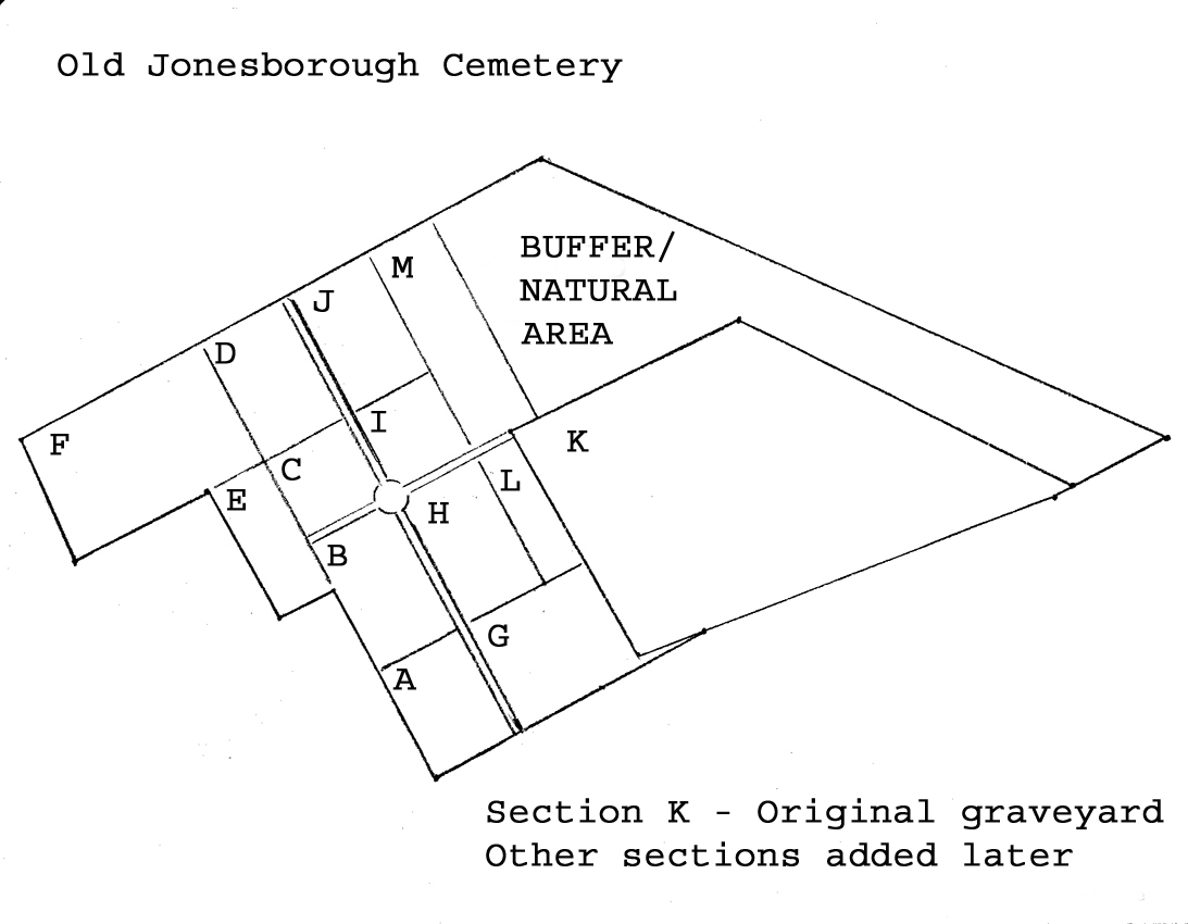
Old Jonesborough Cemetery Map
Click on map to enlarge
TDR = Tennessee Death Record which can be found at the Tennessee State Library and Archives and viewed on Ancestry.com.
Information in [ ] was not on the tombstone but found in other sources.
This survey was based on some earlier surveys. The Inventory of the Old Jonesborough Cemetery, 1995 was initiated and designed by Dr. Gary Burkett and conducted by high school students who were participating in the Governor’s School for Tennessee Heritage at ETSU’s Center for Appalachian Studies and Services. The group of students who did this work were those participating in the “Historic Preservation” module of this program and were under the direction of Mr. Joe Spence, a high school teacher in Lenior City.
Information from some earlier surveys are the Washington County Tennessee Tombstone Inscriptions by Charles M. Bennett and the Watauga Association of Genealogists, used with permission by Loraine B. Rae. The WPA cemetery survey record and an 1927 survey were also used.
Original research: by Jenny Parker and Gene Cox (copied from an undated file)
The Old Jonesborough Cemetery as it currently exists is the result of several transactions that occurred throughout the 1800s. In all, the deeds on record in the Washington County Courthouse account for 2.71 acres of land.
The original tract, known as the Old Grave Yard, was deeded to the Commissioners of the Town of Jonesborough from Patrick Long and totaled approximately 0.35 acres. The deed is recorded in Deed Book 9, Page 191 and was recorded on February 11th of 1803.
On the 25th of July 1849 the first addition to the cemetery was deeded to Seth J.W. Lucky, James Brown, and William G. Gammon, Trustees from John Blair, William K. Blair, and Robert L. Blair. This addition surrounded the original tract on three sides and included approximately 2.12 acres. This deed is recorded in Deed Book 31, Page 351 (through page 356).
This first 1849 addition to the cemetery was bounded at one point by the corner of a house (which no longer stands) belonging to Milton (Wilton) Atkinson. On August 30th of 1849, William G. Gammon, James Brown, and Seth J.W. Lucky, Trustees of the Jonesborough Cemetery granted to Atkinson a parcel of land 15 feet wide and “extending the whole length of the ground purchased of the Mssrs. Blairs from opposite the end of the house now occupied by Pritchet and recently purchased by Atkinson and along the said lot as far as the lot of the said Pritchet extends and which is now enclosed by a plank fence.” Based on the current configuration of the cemetery fence, I have estimated this length to be approximately 130 feet translating to a loss of a negligible 0.04 acres. This transaction is recorded in Deed Book 32, Page 46 (though 48). (GME note – actually 1950 sq ft or about 0.40 acres.)
The final addition to the Old Jonesborough Cemetery was made on February 1st of 1899. This included a group of defined lots numbered 45 to 71, arranged in three rows of nine, each measuring 18 feet by 25 feet according to a diagram recorded with the deed. Assuming the diagram is accurate, this translates to an additional 0.28 acres. My supposition is that this 1899 addition is the current northwestern most corner of the cemetery. The 1899 addition can be found in Deed Book 76 Page 320 (and 321). (GME note – this deed “set(s) a part and dedicate(s) an addition to the……..” AND does not convey title – this will become important as evidenced in Deed Book 95, Page 192).
Please see the accompanying sketch for the locations of the original tract and subsequent additions. (GME note – sketch has not been found, several other maps exist).
Additional research done and compiled by Gordon M. Edwards (July 2014):
The prior research was reviewed and some additional information was found.
With respect to Deed 31 Pages 351-356, several of the plots shown on the plat described within the body of the deed were presold, the proceeds of which went to pay off this acquisition. The plots that were paid for in full, were so designated within this deed, by plot number and purchaser’s name upon conveyance in 1849. The acquisition was bound by the first and second parties in 1847, however, conveyance did not occur until 1849. Only one deed has been found which records a specific plot payment in full and designates a name. That is Deed Book 59 Page 190 and is noted as “Receipt for square 39 in graveyard”. Lucky, Brown, and Gammon to J.M. Brown – May 17th 1859. It is unknown as of this writing how or if additional plot sales were receipted.
The “Colored and Strangers Section”
Within the body of Deed Book 31, Pages 351 to 356, the following was noted. The following was written in the last paragraph of a several page long deed. This deed was the conveyance for the large addition to the original graveyard. Most of the land conveyed was the area now found with the garden styled plots and the larger marble markers. A small strip of land on the east side of the old graveyard was part of this conveyance, as well.
…..“The said Trustees are furthermore empowered to set apart such portion of the land herein conveyed and not otherwise disposed of as they may deem proper for the burial of colored persons and strangers.”…..
Colored Section
29 Feb 2016
From Railroad Journal and Family Visitor, dated January 7, 1854. An article on the Jonesboro Cemetery (sic) appeared on the front page. Within this article, a paragraph was dedicated to describing the area set aside for the colored population.
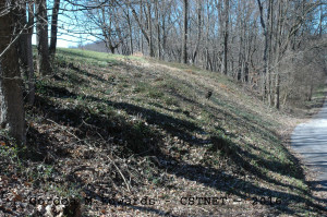
…..”In the eastern portion of the graveyard is the portion appropriated to the colored population. It is comprised in a narrow strip extending the full length of the old graveyard and located on a steep declivity which extends nearly to the eastern onclosure (sic).”…..
This strip of land is the hillside on the immediate western edge of the present Cemetery Lane road. For many decades this area was overgrown. In 2014, it was cleared of briars, brush, trees, and debris. One can now clearly see the depressions of several dozen graves, however, no markers of any kind have been found. The names of those buried here remain unknown.
College Hill Cemetery (see separate entry) was not deeded until 1890. That cemetery was deeded for the benefit of the colored population.
No confirmation of a “strangers” section has been found.
The “Deaderick Corner”
Three deeds have been found that cover property in the “Deaderick corner”. These three deeds were all executed by A.S. Deaderick, then owner of the property to the west of the 1849 addition. These three deeds affect property just to the north of the 15 foot section noted in Deed Book 32, Pages 46-48. It appears to this researcher, that Alfred S. Deaderick unofficially dedicated a small area for his family burials, and sold off three smaller parcels within that small section. The three deeds are recorded in Deed Book 50, Page 403-404; Deed Book 76, Page 315; and Deed Book 93, Page 490. Current placement of grave markers substantiate this as well. A.S. Deaderick did retain some of that rectangular parcel for his own use, as evidenced by markers, as well.
The “Dosser Terrace”
In the 1899 addition, Deed Book 76 Pages 320 & 321, the right to the property, although designated as an addition to the cemetery, remained in R.N. Dosser, et al. It appears that the eastern plots were used and the western ones were not. In 1907, R.N. Dosser et al, conveyed a parcel to George L. Smith, reference Deed Book 95, Page 192, which included part of the 1899 tract. By dimensional calculations, plots 49 & 58 of this 1899 addition were to remain with the graveyard and owned by Smith. The other 12 plots were unconditionally conveyed to Smith. No deed has been found undesignating those 12 plots, however, wording in DB95P192 implies as much. Smith later conveyed to Patton, reference Deed Book 99 Page 254. That deed does not include the graveyard portion. This would indicate that ownership of those two plots (49 & 58) remained in George L. Smith. Markers for Smiths and Pattons fill those two plots. (Note – Smith’s daughter married Patton).
From Association to the City
The final deed found is recorded at Roll 607, Image 2122. This 2008 QD transaction conveys from the cemetery trustees to the mayor and aldermen. A complete land survey was done at that time.
Also refer to the separate entry for the College Hill/Evergreen Cemetery.
Researched and donated to the Washington County TNGen Web July 2014 by Gordon M. Edwards, member of the Cemetery Survey Team of Northeast Tennessee.
Copyrighted 2014 by the Cemetery Survey Team of Northeast Tennessee. No part of this work may be copied without written permission from the Cemetery Survey Team.