 Introduction
Colonial Period
Squabble State
Land Registration In Early Middle Tennessee, Laws and Practice, by Daniel Byron
Dovenbarger
Tennessee Counties Mentioned in North Carolina Land Grants, by A. B. Pruitt
Land Grants in Tennessee by North Carolina, by A. B. Pruitt
Land Ordinance, 1785
(United States Territory North of the River Ohio)
Northwest Ordinance, 1787
(United States Territory North of the River Ohio)
North Carolina Cedes Her Western Land,
1789-90
United States Territory South of the River Ohio,
1790-1796
1796-1806 (Tennessee Statehood to the Compact of 1806)
Compact of 1806
The Intruders. Illegal Settlers on Indian Land.
Indian Land Cessions in Tennessee. (Federal Period)
Colonial Period Indian Land Cessions. (An Overview)
Cherokee Nation Cessions, a Map
Chickasaw Nation, by Fred Smoot
North Carolina’s Relationship with Tennessee, by Gale Williams Bamman, CG, CGL
North Carolina Land Grants in Tennessee
Warrants, Pre-emptors, Certificates, Grants
Petition of Tennessee General Assembly to U. S. Congress in 1817
Tennessee Land Law and Legislation
Tennessee Courts and Land Litigation
Land Fraud
Military Bounty Land Warrants and the Glasgow Land Fraud, by
A. B. Pruitt
Land Surveying
Metes and Bounds System of Survey, by Fred Smoot
The Maps Our Ancestors Followed. A TNGenNet Inc. History Project.
Land Record Sources
Land and Schools
Tennessee State Boundaries
Walker & Winchester Lines
Tennessee ~ Georgia Survey
Bright’s 1807 Southeast Survey. See 2nd Surveyors’ District
Map
Tennessee County Boundaries
Surveyors’ Districts,
by Fred Smoot
Tennessee’s First Major Land Law ~ 1806.
The Surveyors’ Districts.
2nd Surveyors’ District Map,
by Fred Smoot
3rd Surveyors’ District Map,
by Fred Smoot
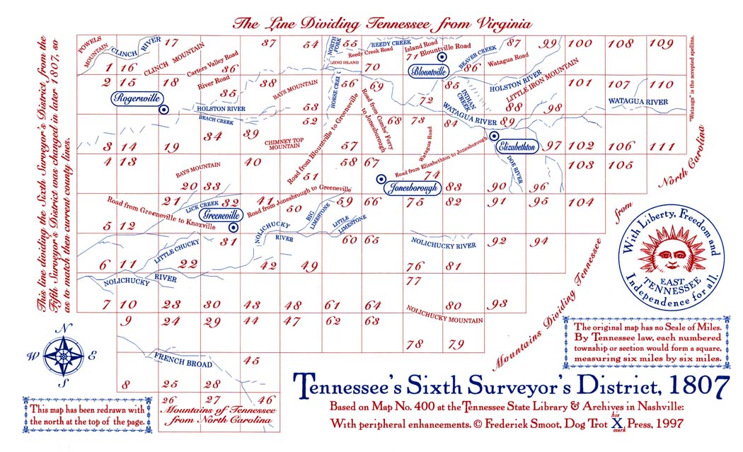
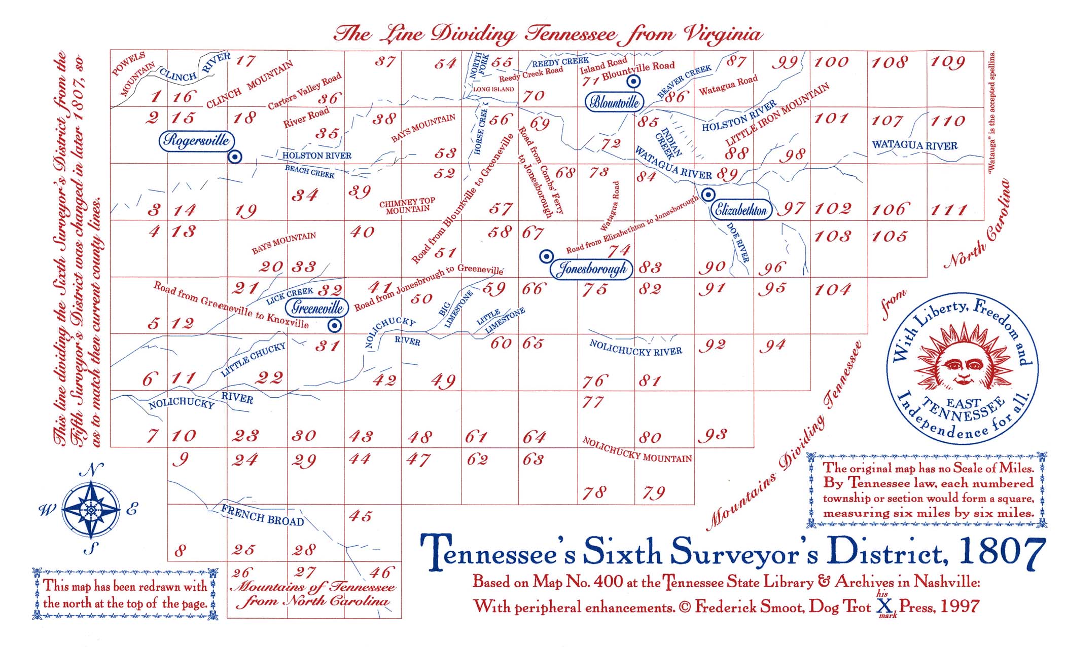
6th Surveyors’ District Map ::
Larger Version,
by Fred Smoot
District South of the French Broad and Holston, a Map
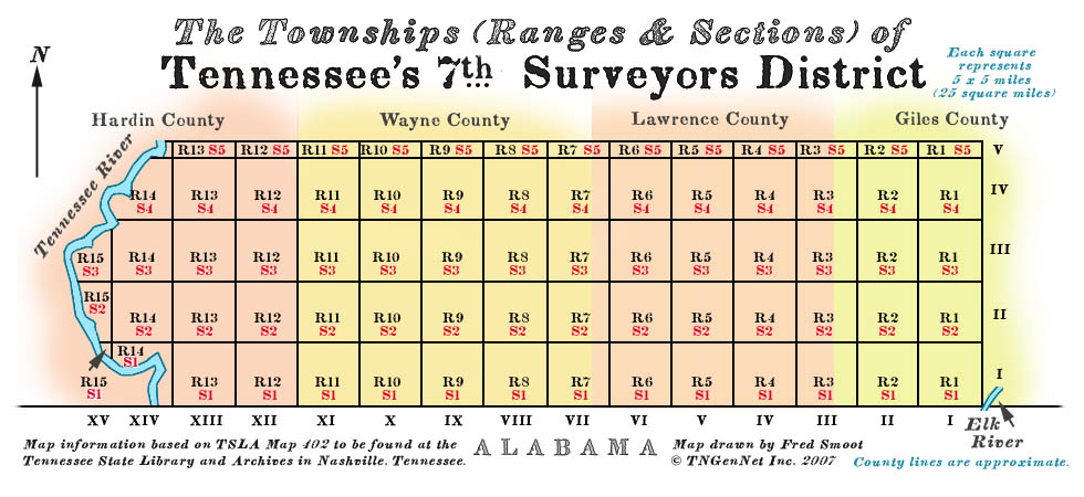
7th Surveyors’ District, a Map
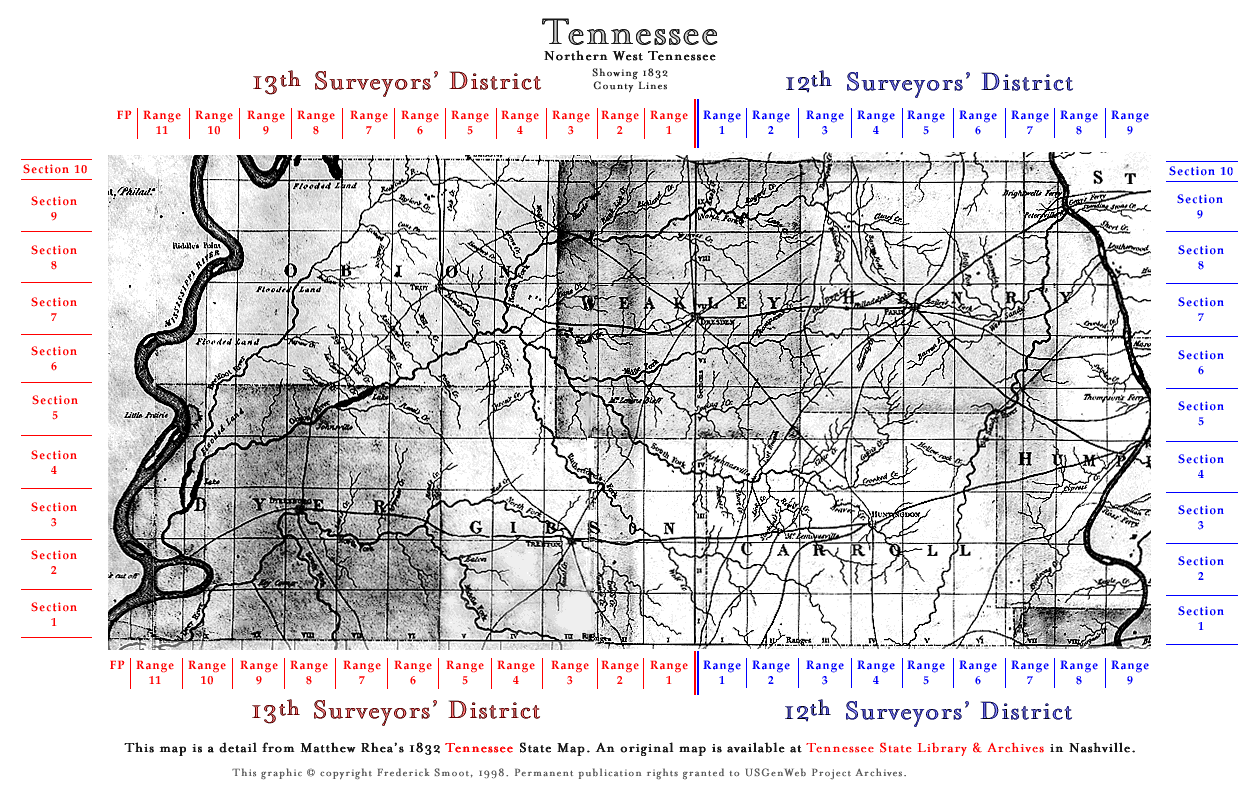
12th & 13th Surveyors’ Districts Map,
by Fred Smoot
Tennessee Valley Authority
Homesteading on the Cumberland, 1930s
Land Terminology, by Fred Smoot
Trees, by Fred Smoot
Warren County Land Records


