Civil Districts 1-25
Weakley County, Tennessee
U.S. Census years 1920-1930
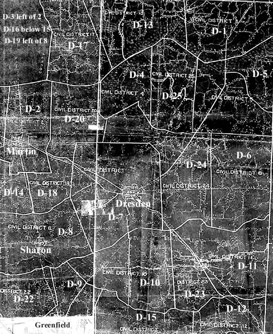
Garry Brown found a Map in the State Archives with the Civil Districts of Weakley County, Tennessee for the year 1950. It looks like it would be the same for U.S. Census years 1920 & 1930, and maybe 1910 also. Many thanks to Gary for sharing. I have played with it, adding District numbers, so you can see a little better and also added the towns of Greenfield, Sharon, Martin and Dresden.
You can compare it to our Maps of 1870 and 1880 which had 18 Civil Districts to see where districts 19 thru 25 were made. There is no District 21.
This map has the District lines plus major roads & railroads. The North Fork of the Obion River is still the Southern border line for Districts 17, 13, and 1. It the Northern border for districts 3, 2, 20, 4, 25, and 5. The Middle Fork of the Obion River is bordered on the North by districts 19, 8, 7, 24, and 6. It is bordered on the South side of River by districts 22, 9, 10, 23, and 11. The South Fork of the Obion River is really off the map but is bordered on the North side of river by districts 22, 9, 15, and 16.
I hope this helps you see in what part of Weakley County your kinfolk lived…..MaryCarol