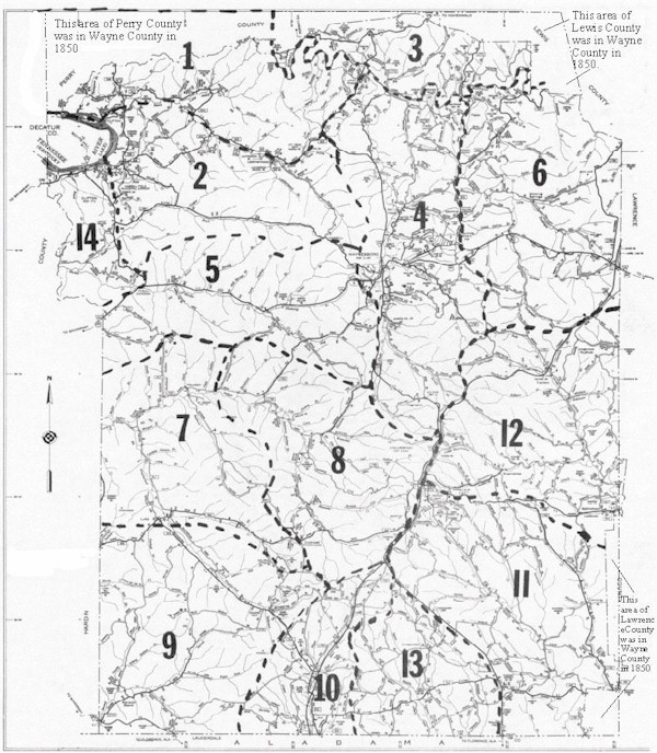
Map Of Wayne County, Tennessee
Showing The Approximate
Boundaries Of The Civil Districts
At The Time Of The 1850 Census
This map was drawn by Edgar D. Byler, III over the 1981 County Road Map.
Civil District boundaries are approximate due to the change in roads and county
boundaries between 1850 and 1981. This map is provided only as a help to
researchers trying to locate the approximate residence of people enumerated
in the 1850 census. Please use with caution. The heavy slashed lines represent the
approximate location of the district boundaries. The large numbers are the
district numbers.