|
(This site is best viewed using Microsoft
Internet Explorer)
----------

"Become a Fan" or "Like" our page and get
automatic notifications to your wall when we post updates to this site!
----------
Fast Links to Different Parts of this
Website:


-----------
Links to other Websites:


| |
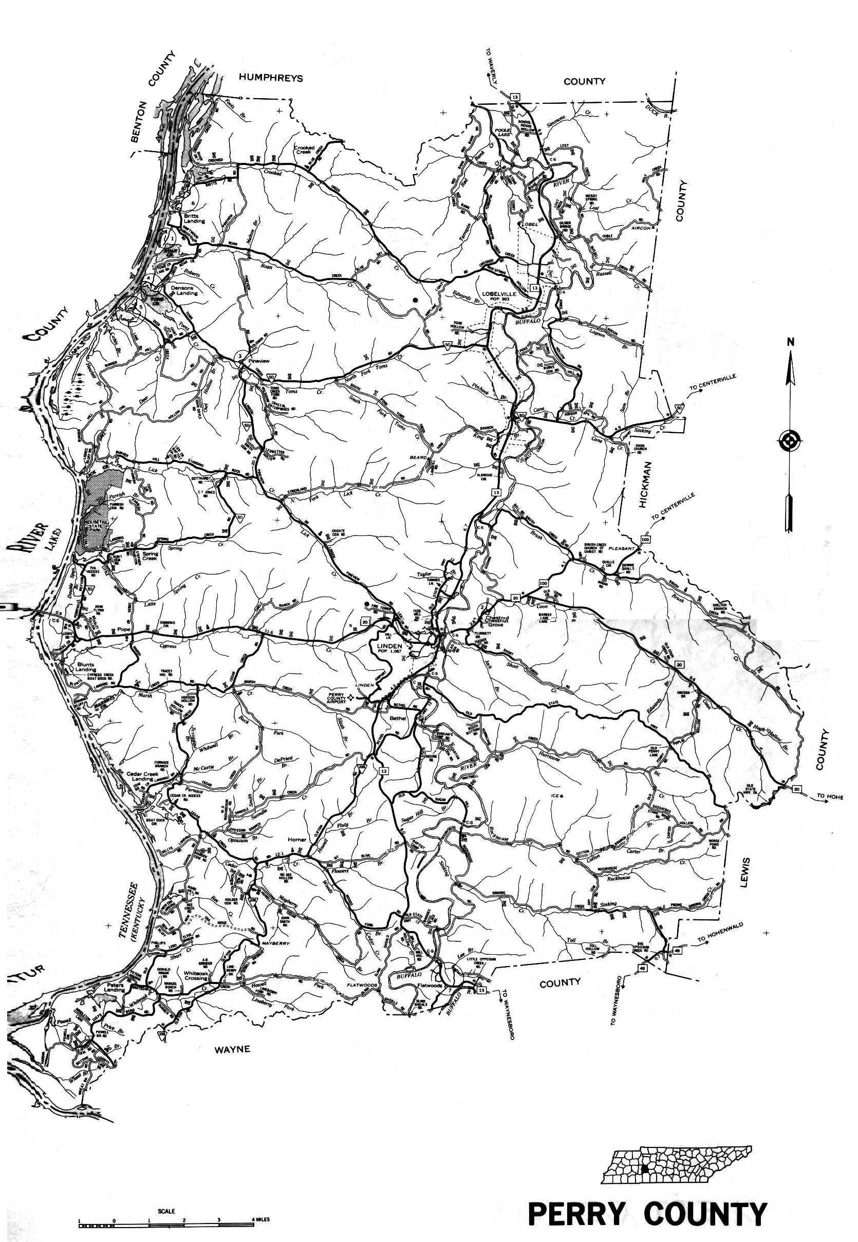
Perry County, Tennessee
Maps
In understanding a family, it is
essential to understand the area they lived in.
-
Looking up your ancestor on the
appropriate federal census record will also sometime identify the area your
ancestor lived in. Census records of Perry County will usually indicate
a civil district. So examining a civil district map would be extremely
useful. Sometimes the census records will even indicate a road, or if
you're really fortunate, a house number on that road.
-
Examining land records will give
a description of the property your ancestor lived in. This may include
neighbor's names, names of nearby rivers or streams or roads. By
studying a map of the county, both of the time frame that your ancestor lived
there and today, it might be possible to locate the property your family
owned.
-
Migration trends are important,
too. When a family moved from one area to
another, many times it was with fellow family members. Either
families would travel together, or some family members would migrate and then
have other family members follow them within a couple years.
If they went by themselves, then they would usually follow a recognized
migration trail. Migration could also be as a result of a soldier earning
a land bounty warrant - he would either sell it or use it to buy land in an
unsettled area. If they just "showed up" in an area, then an understanding
of the migration trails might help you trace back to where they may have come
from.
The purpose of this page
is to give you guidance on both maps of Perry County, as well as links or
information on migration trails to Perry County. If anyone has any website
links or original materials for these purposes, please e-mail
Jan Monnin. Thank
you.
|
Page or Map (click on the name to go to that page) |
Submitted by |
Date |
|
TnGenWeb project
- Maps our Ancestors Followed |
Jan Monnin |
18 Aug 2008 |
|
2009 Maps of Tennessee
You can now order the new and
improved maps of Tennessee. It features information and interstate miles and
exit markers. It has information about emergency reference markers and
information about Tennessee 511. And it is all on a larger scale, making it
easier to read.
Order on line at:
www.tn.gov/tdot/MapOrder/maporder.htm
|
Peggy Coleman |
|
| |
|
|
|
