Hawkins County Boundaries in 1790
Cartographer-extraordinare Charles Reeves created this map of Hawkins County’s boundaries in 1790. The source was a hand-drawn map found in the Stamps Library in Rogersville about 1996. 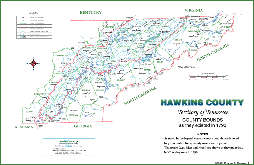 Click on the image to see an enlargement.
This map is posted here with permission of Charles Reeves. Please contact him for reprints of the full map or segments.