Bradley County Maps
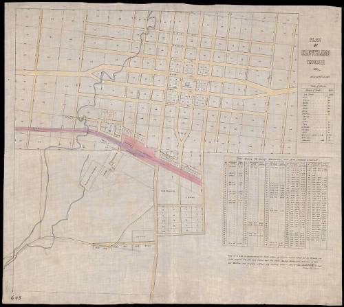
Plan of Cleveland, 1860
From TeVA deion: Note reads "Copy of a map in possession of the Raht Estate of Cleveland, Tenn. Made for my private use. In the original, the lots were tinted, and the table showing dimensions and area of lots was written out in full, without any dotting down." The map is drawn in black and colored inks on architectural cloth. Tables include: Table of streets -- Table showing the average dimensions and area contained in each lot. Larger version downloadable from https://teva.contentdm.oclc.org/digital/collection/p15138coll23/id/10036/rec/13
Maps are important for historical and genealogical research, but they are crucial for understanding the development of Bradley County across time.
Maps of the region before the Cherokee Cession show important geographic and topographic landmarks. County boundary maps show how the county formed from its parents as well as how it existed after its “child” counties were set off.
Researching Bradley County land ownership presents a situation somewhat unique in East Tennessee: land is described in both metes-and-bounds and townships/ranges/sections, depending on the record.
This is a small selection of maps that will, we hope, provide researchers with a starting point. One can never have too many maps!


Comments
Bradley County Maps — No Comments
HTML tags allowed in your comment: <a href="" title=""> <abbr title=""> <acronym title=""> <b> <blockquote cite=""> <cite> <code> <del datetime=""> <em> <i> <q cite=""> <s> <strike> <strong>