↓
 

Overton – Fentress – Pickett Counties TNGenWeb Project

Three counties, connected by history, geography, and so much more!

  • What’s New?
  • Local History and Information
    • Civil War History
    • Historic Sites
    • Maps and Gazetteers
    • Research Repositories and Contacts
  • Photo Albums
  • Research Aids
    • Individuals and Families
    • Searchable Databases
    • Cemetery and Burial Records
    • Ethnic Research
    • Military Records
    • Public Records
      • Census Records
      • Court and Council Records
      • Land and Property Records
      • Tax and Assessment Records
      • Vital Records
    • Religious Groups
    • Schools and Education
    • Business and Industry
    • Newspapers and Publications
    • Miscellanea
      • Off-Site Links
      • Communication and Exchange
  • TNGenWeb Project Links

Category Archives: Maps

Post navigation

Newer posts →

Overton County Private Legislative Acts – County Boundaries: Historical Notes

Overton - Fentress - Pickett Counties TNGenWeb Project Posted on August 29, 2021 by TNGenWebAugust 29, 2021

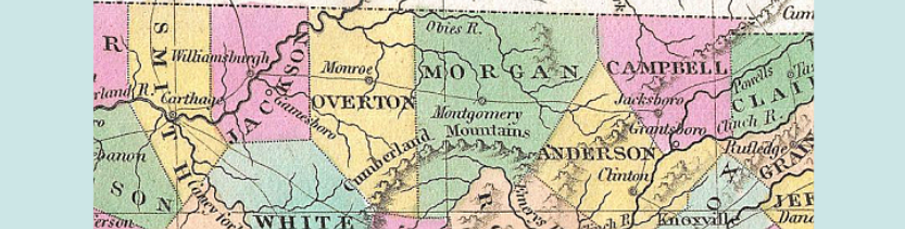
  The following is a summary of other acts that authorized boundary changes for Overton County. Acts of 1806, Second Session, Chapter 50, permitted James Chissum, of Overton County, to run the true boundary lines between Overton County and Jackson … Continue reading →

Posted in Land Records, Local History & Information, Maps, Public Records

Overton County Private Legislative Acts – County Boundaries

Overton - Fentress - Pickett Counties TNGenWeb Project Posted on August 29, 2021 by TNGenWebAugust 30, 2021

Creation of the County Acts of 1806 (2nd Sess.) Chapter 27 COMPILER’S NOTE: The first seven sections of this act did not involve Overton County and are not included. SEC. 8. That a new county be, and is hereby established … Continue reading →

Posted in Land Records, Local History & Information, Maps, Public Records

Map of Overton County Cemeteries Contributed by Sandra Ellis

Overton - Fentress - Pickett Counties TNGenWeb Project Posted on August 28, 2021 by TNGenWebAugust 28, 2021

Sandra Ellis’ photographs and transcriptions on this site are from the Glassscock, Hammock, Hunter, Poteet, Tompkins Cove, and Verble-Wilson (on Henry Wilson Farm) Cemeteries. Search for those cemeteries in the Research Aids section of the top menu or by keyword … Continue reading →

Posted in Cemetery & Burial Records, Maps

USGS Topo Map Locations for Overton, Fentress, and Pickett Counties

Overton - Fentress - Pickett Counties TNGenWeb Project Posted on August 27, 2021 by TNGenWebSeptember 11, 2021

The table below contains approximately 1,500 places identified on US Geological Survey topographic quadrangle maps for Overton, Fentress, and Pickett Counties.  The data are drawn from https://geonames.usgs.gov/ Professional cartographer, author, historian, and TNGenWeb Project volunteer Charles Reeves, Jr., creates customized … Continue reading →

Posted in Historic Sites, Local History & Information, Maps

Olympus Community, Pickett County

Overton - Fentress - Pickett Counties TNGenWeb Project Posted on August 15, 2021 by TNGenWebJanuary 18, 2022

Do not go look on present day maps for Olympus, TN. Its existence is now only history. If you look on present day maps you may find Olympus Drive but not Olympus, TN. Olympus, TN was the first post office … Continue reading →

Posted in Historic Sites, Individuals & Families, Local History & Information, Maps

Upper Cumberlands Region Civil War Study Guide (National Park Service)

Overton - Fentress - Pickett Counties TNGenWeb Project Posted on August 15, 2021 by TNGenWebAugust 15, 2021

The Civil War in the Upper Cumberland Plateau and Its Effects on the Local Population: A Guide of the Major Events and Themes, for Teachers and Interested Citizens of the Upper Cumberland Plateau of Tennessee and Kentucky by Stephen McBride, … Continue reading →

Posted in Civil War History, Historic Sites, Individuals & Families, Local History & Information, Maps, Photo Albums

1923 Maps of Landowners in Dale Hollow Lake Impoundment

Overton - Fentress - Pickett Counties TNGenWeb Project Posted on August 14, 2021 by TNGenWebAugust 19, 2021

These maps are from 1923 and it shows people who lived down on the river. This land is now covered by Dale Hollow Lake. It includes families of Clay, Pickett, and Overton Counties. This information was provided by Carl C. … Continue reading →

Posted in Historic Sites, Local History & Information, Maps

Post navigation

Newer posts →


TNGenWeb logo

TNGenWeb Project is a Tennessee-chartered non-profit organization

Search this Site

Interested in Sharing?

Adoptable
Click to learn more!

Categories

Coordinator(s)

Your coordinator(s) for this site: Billie McNamara (temporary!)

Get Site Updates

  • Facebook
  • Twitter
  • Instagram
  • Pinterest
  • Email Newsletter
  • Subscribe with Feedly
  • Subscribe with RSS reader
  • Learn more about update options

Overton Co. Cemetery Map


cemetery map

Fentress Co. Cemetery Map


cemetery map

Pickett Co. Cemetery Map


cemetery map
TNGenWeb Project is an affiliate of USGenWeb Project.

Copyright Statement

Unless otherwise indicated, all data and information on this site are copyright (c)1996-present to TNGenNet, Inc.  All international rights reserved.

Site last updated

Site last updated March 5, 2025 @ 10:33 pm
©2025 - Overton - Fentress - Pickett Counties TNGenWeb Project - Weaver Xtreme Theme
↑

Site last updated March 5, 2025 @ 10:33 pm