 |
|
|
|
|
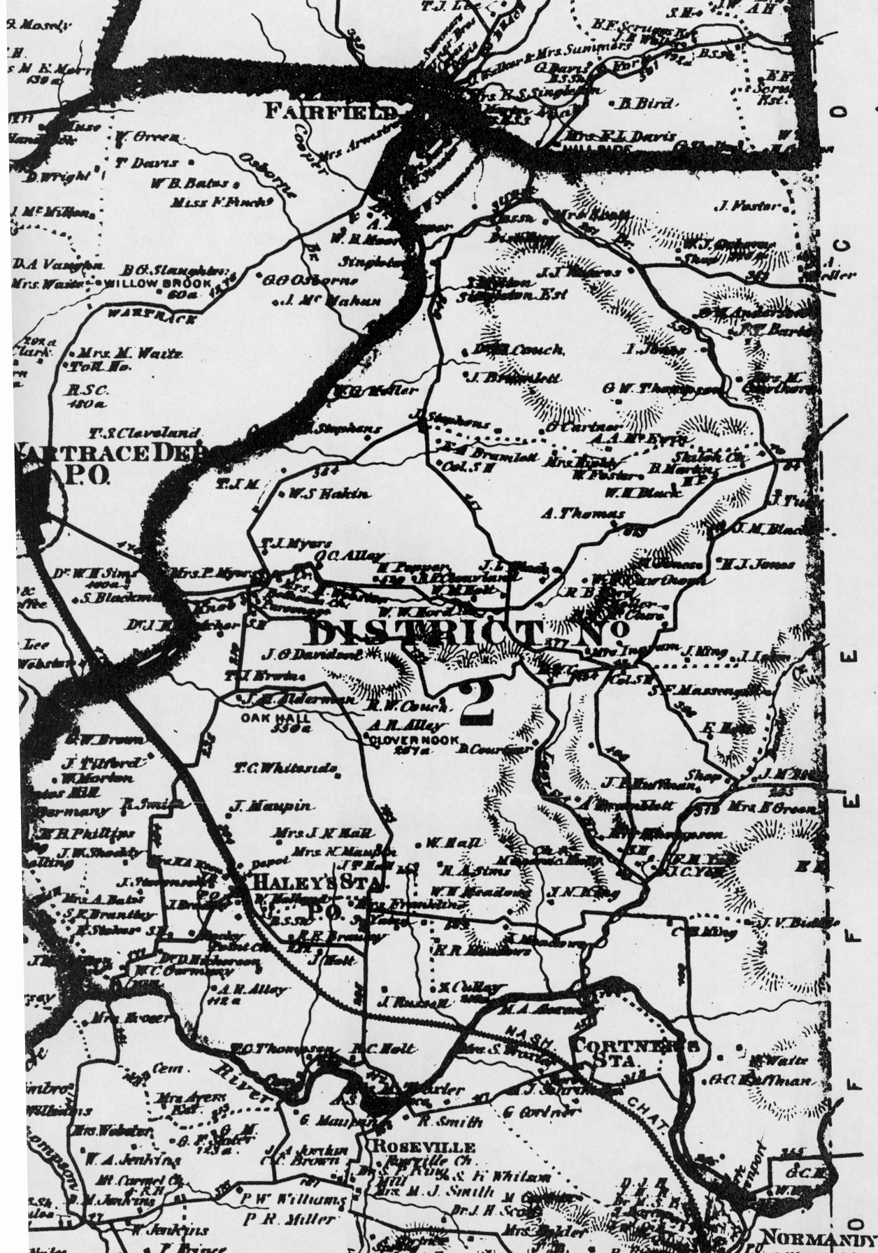
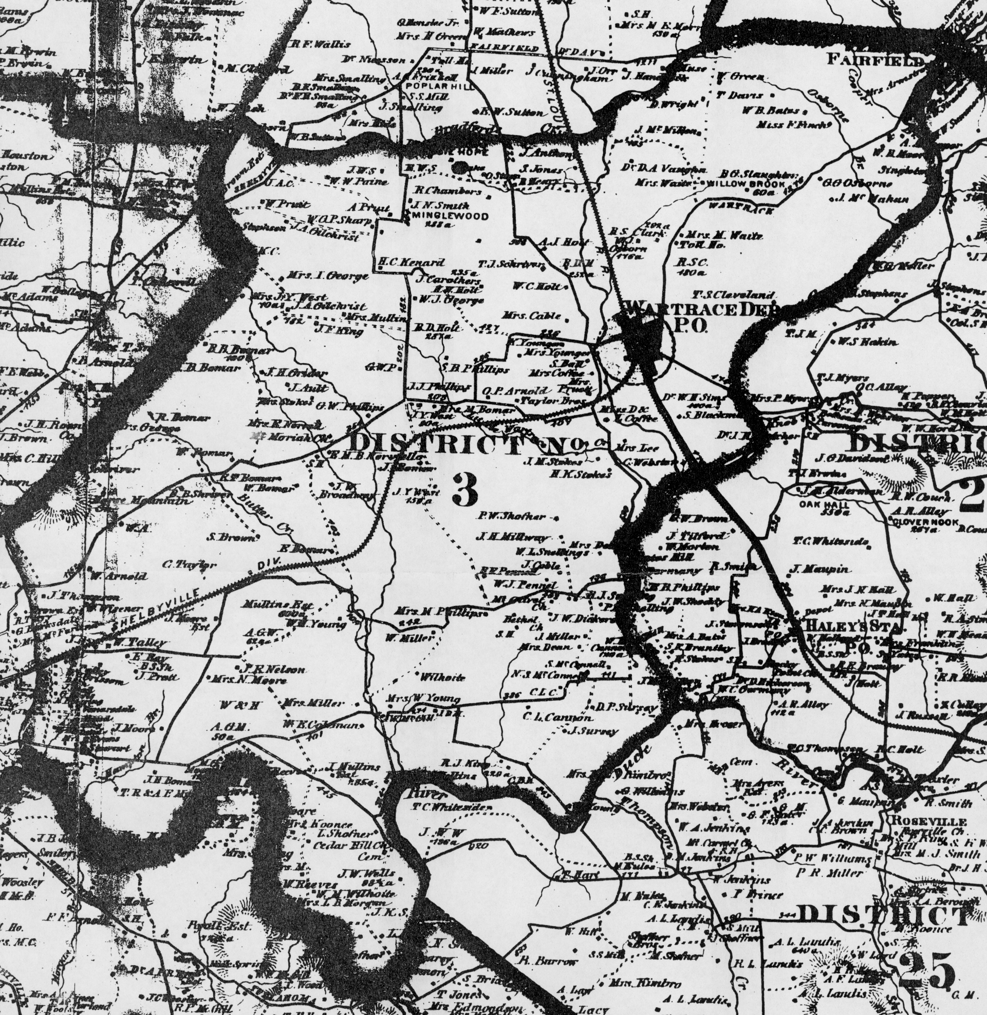
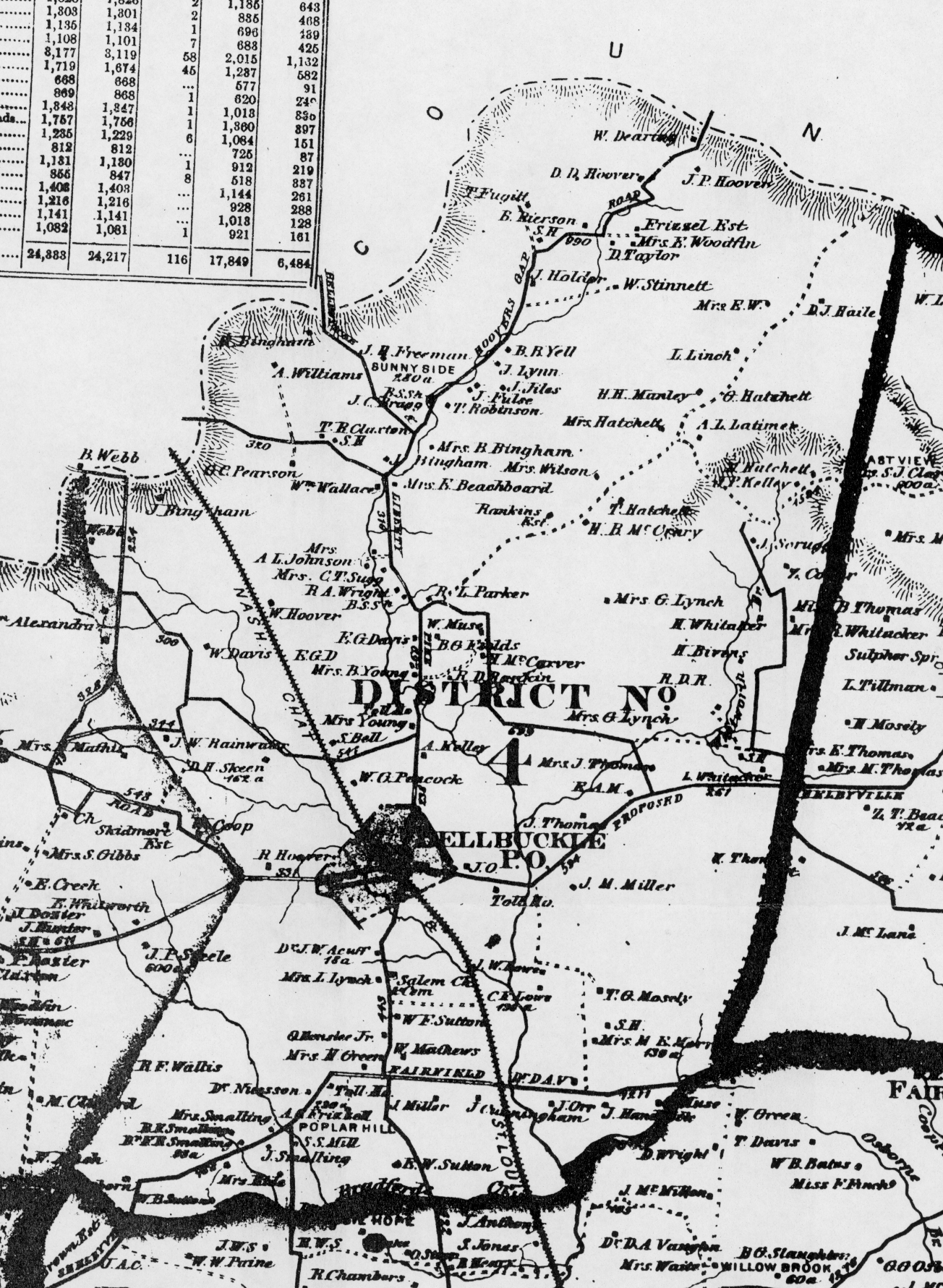
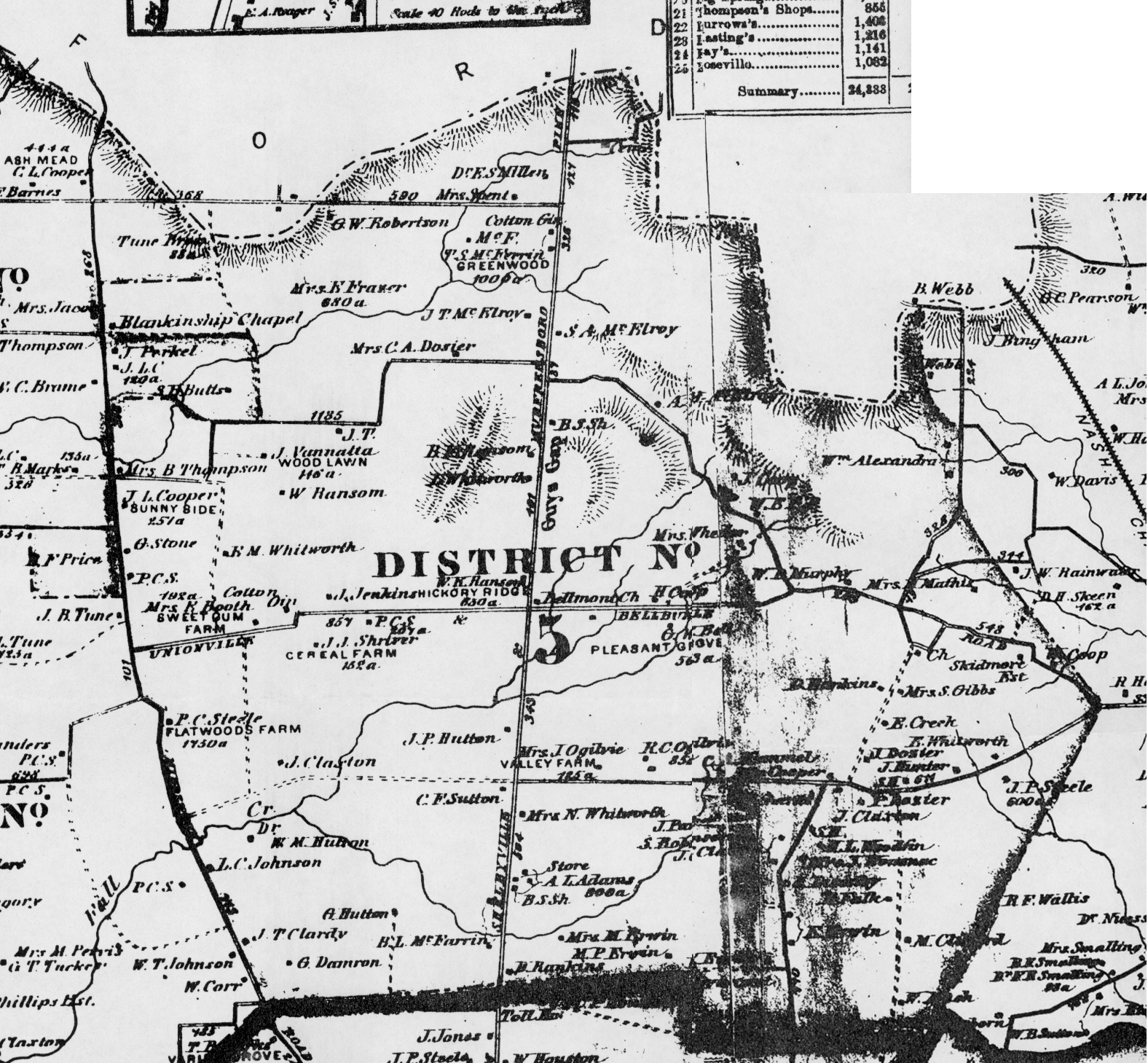
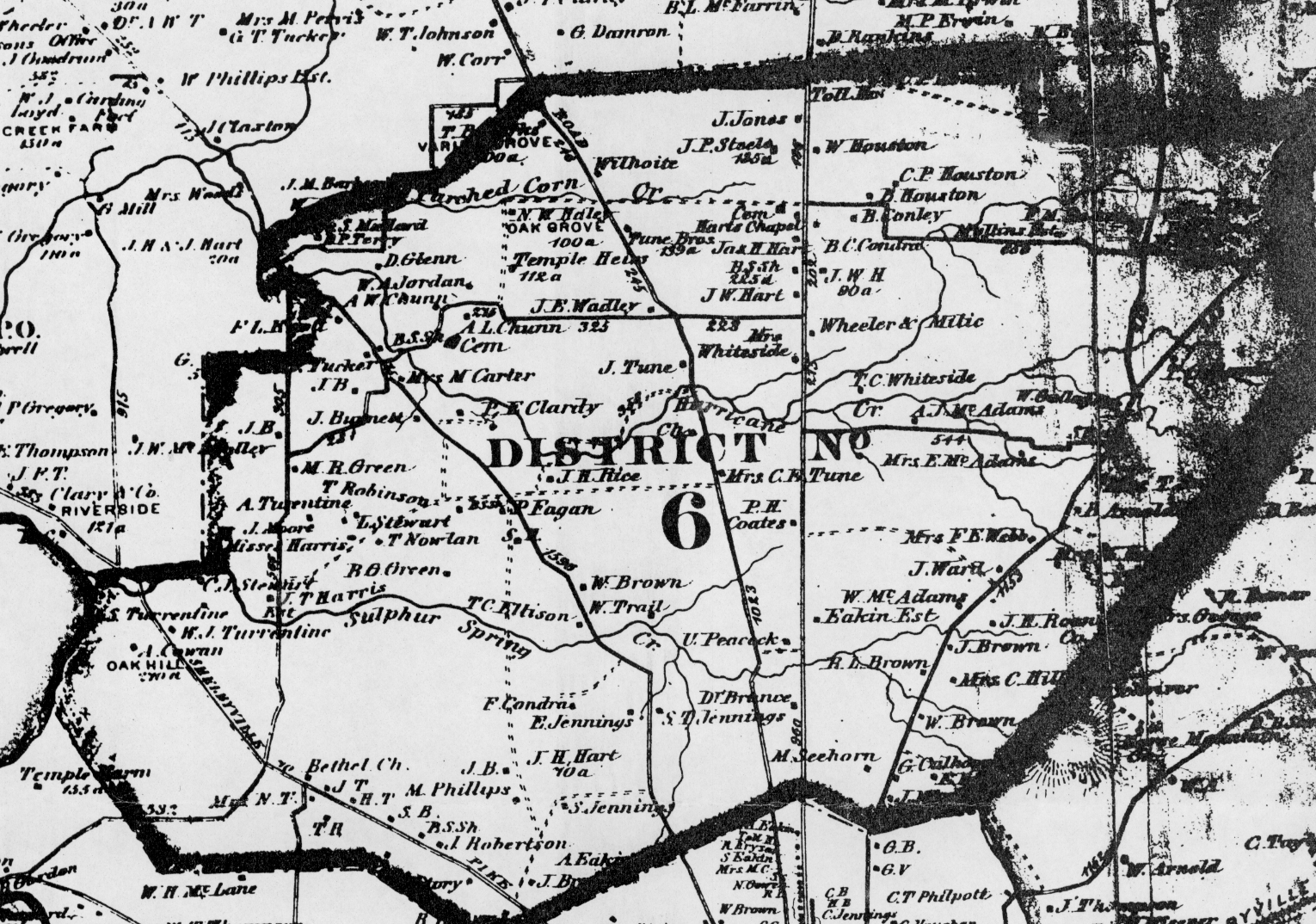
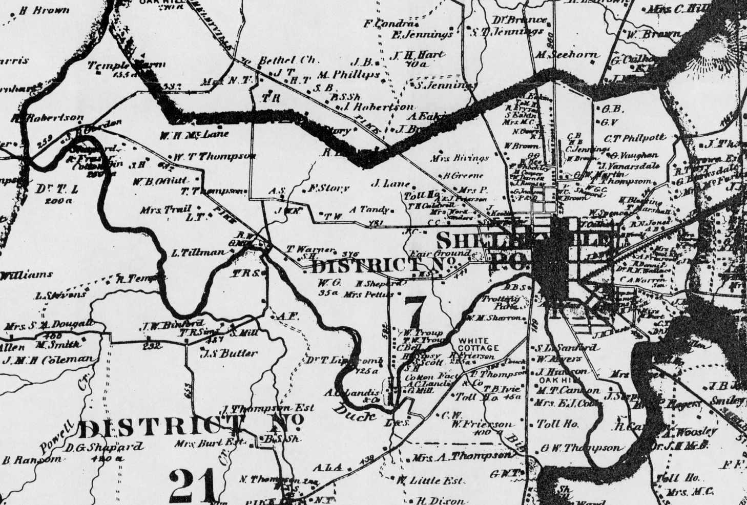
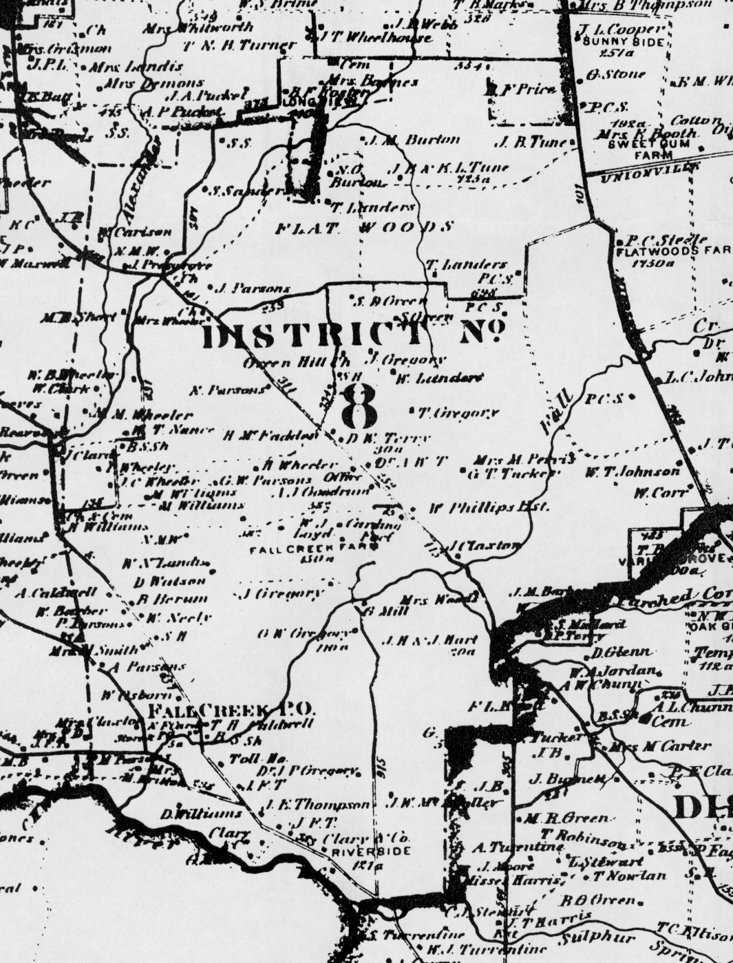
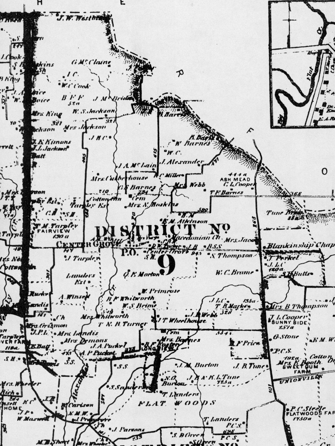
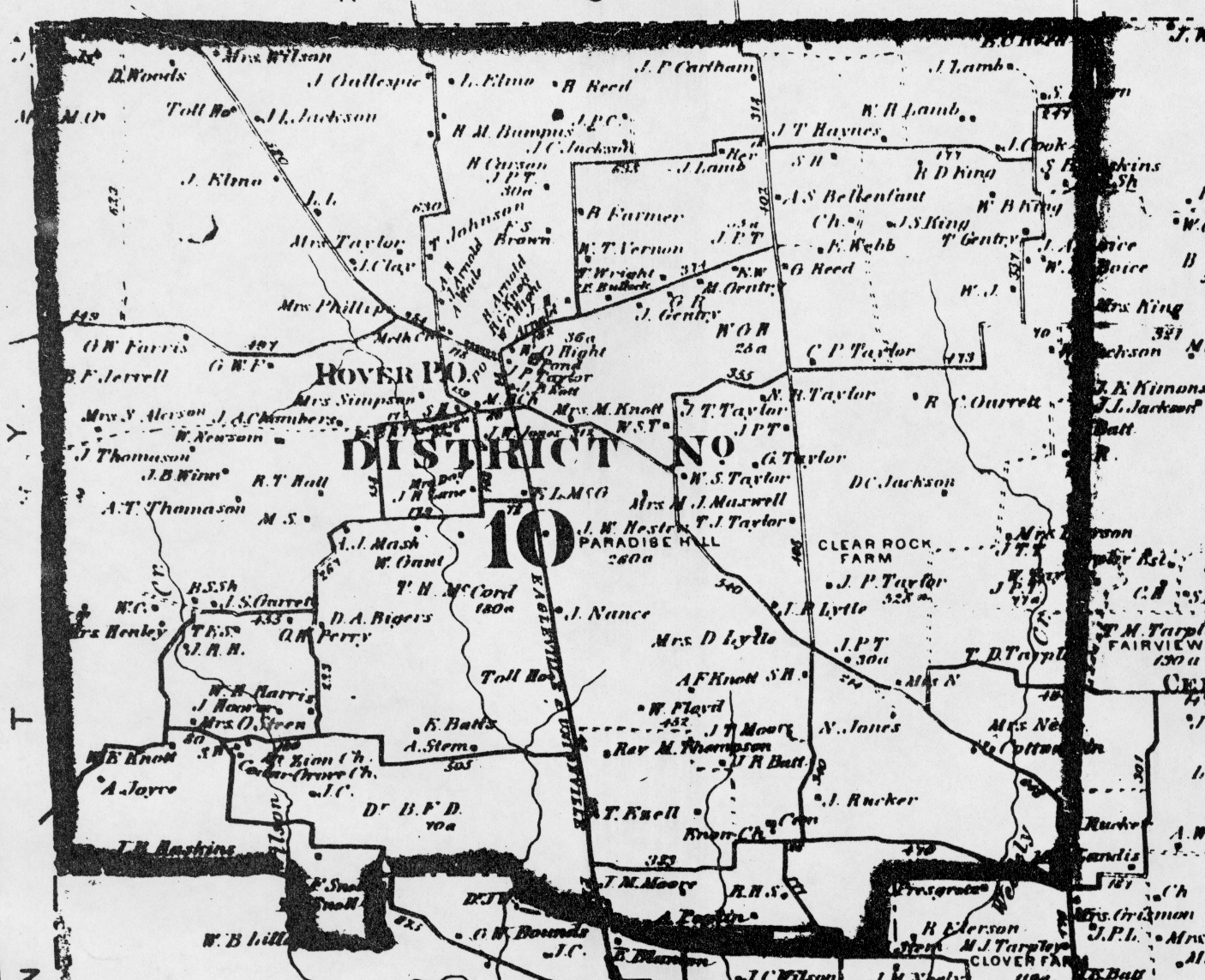
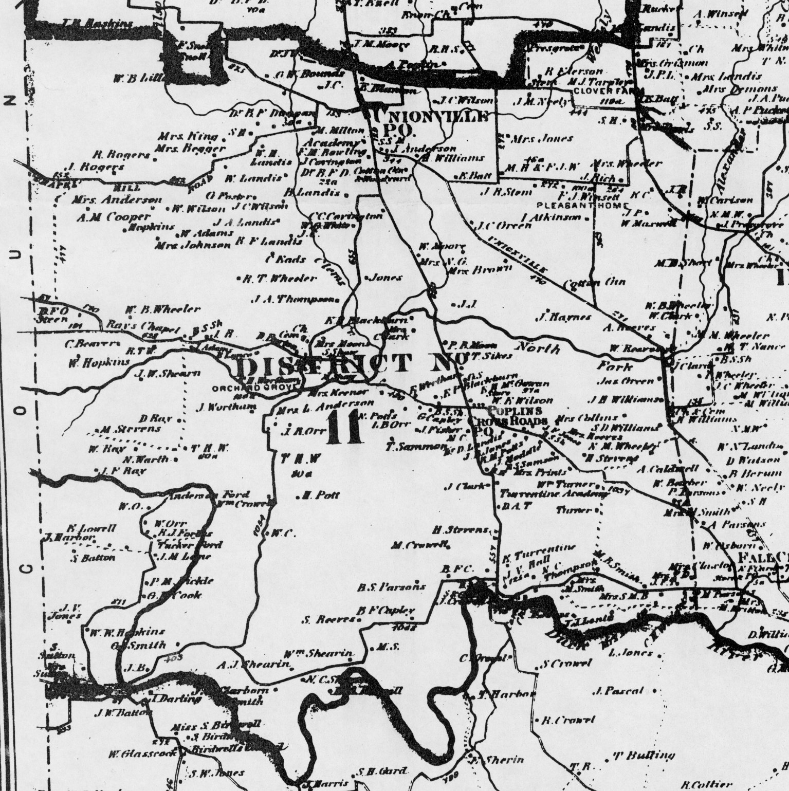
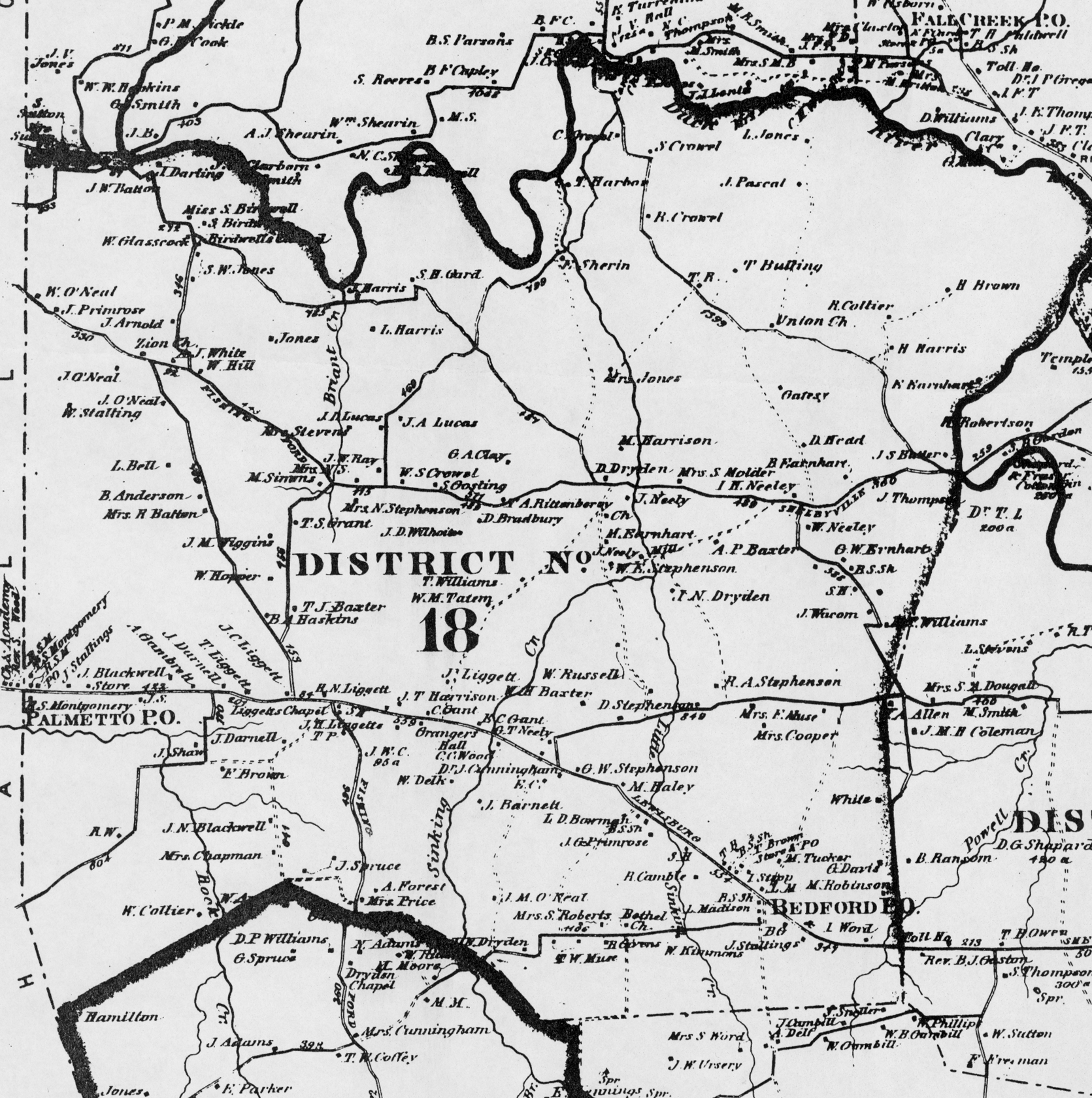
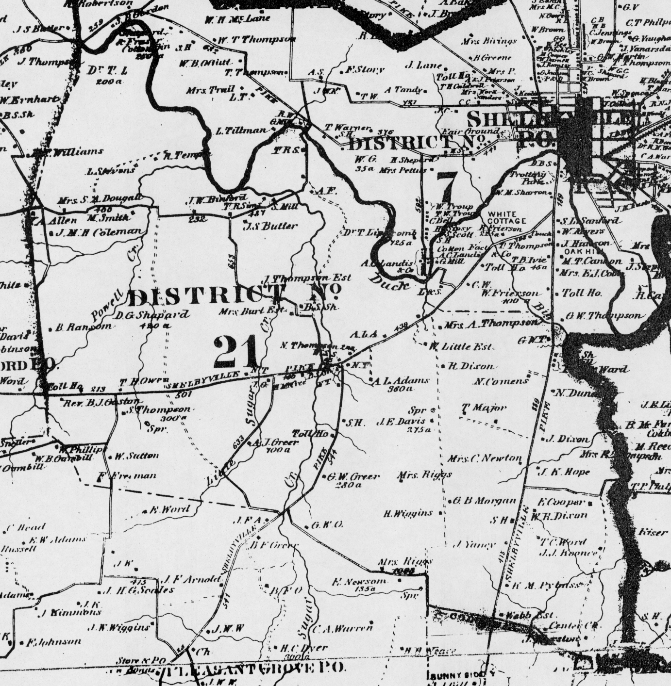
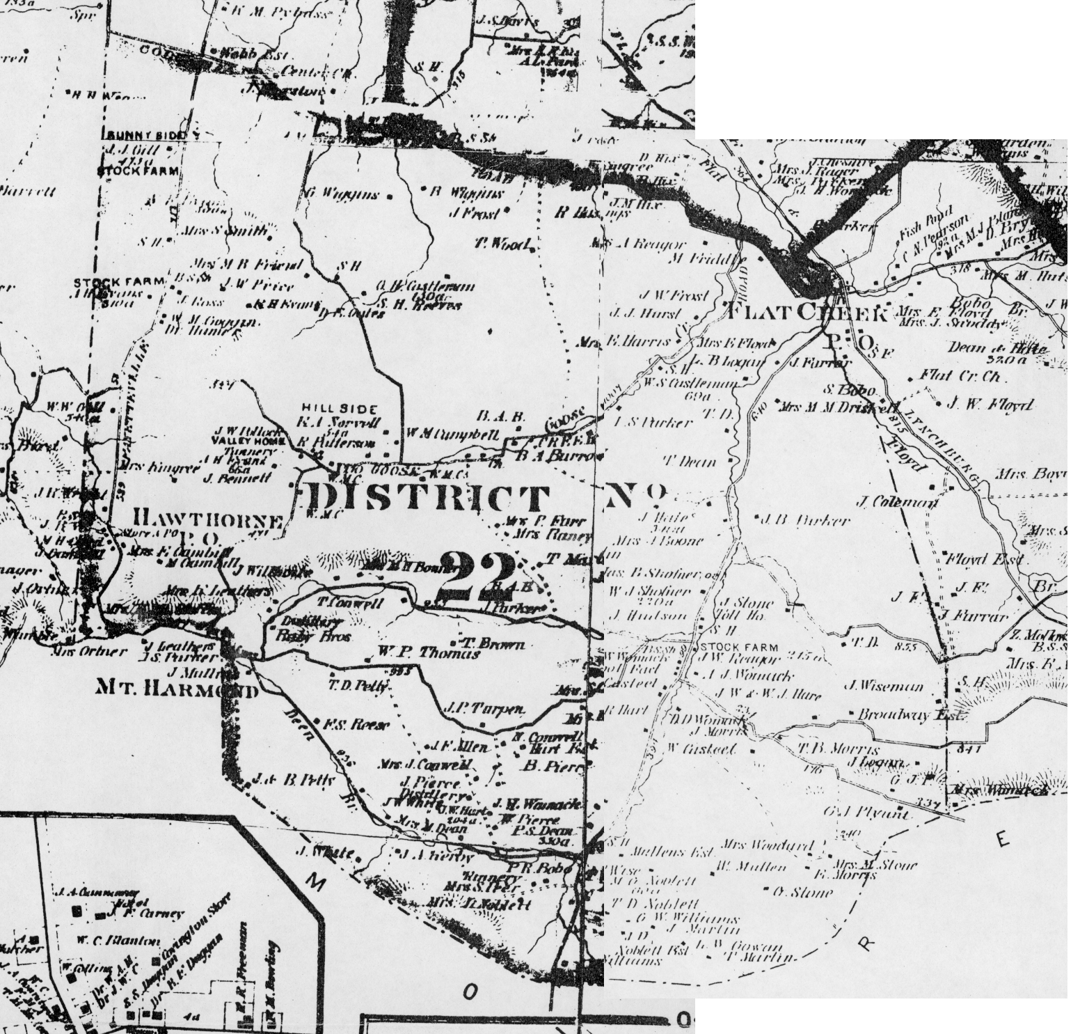
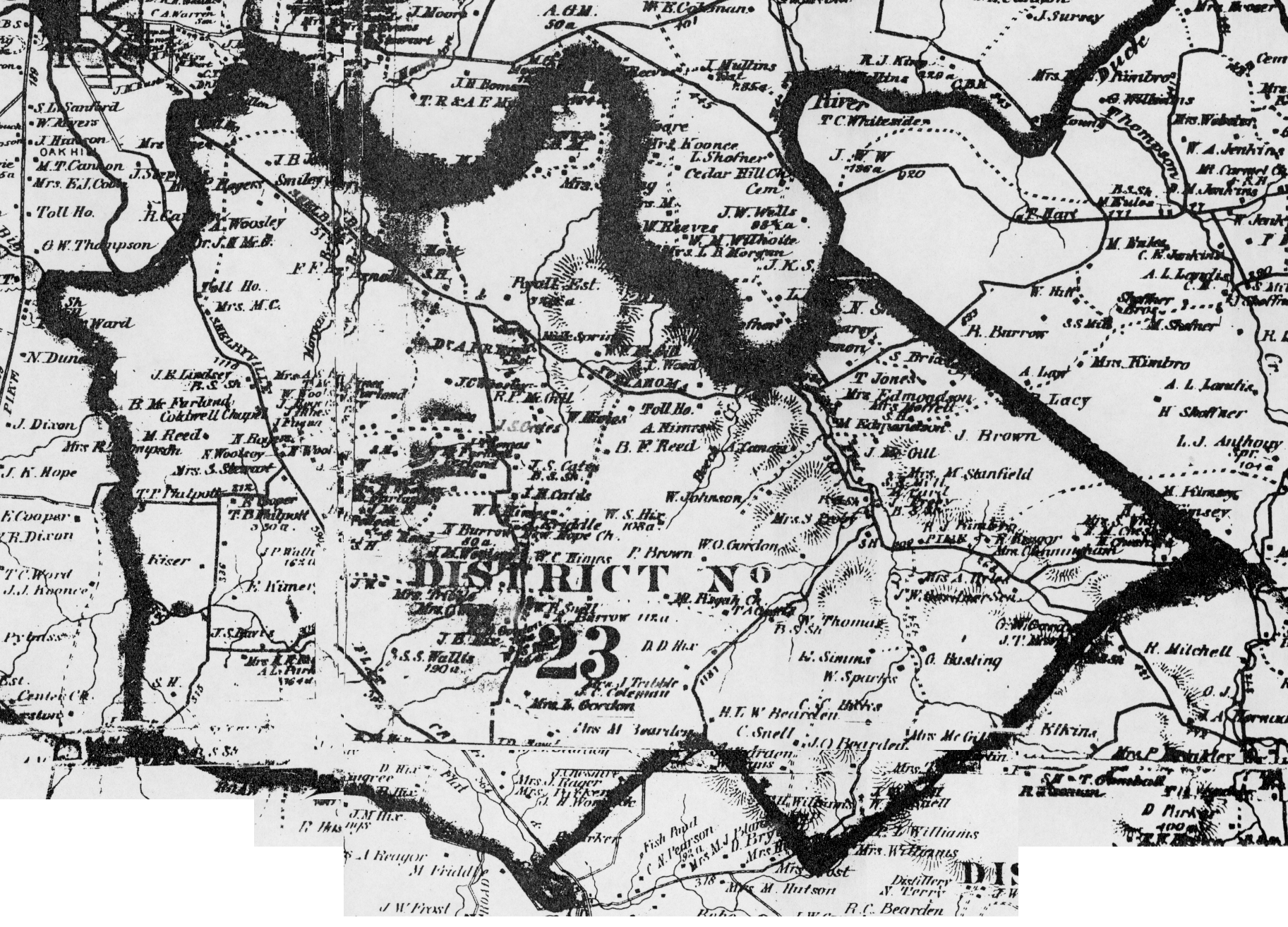
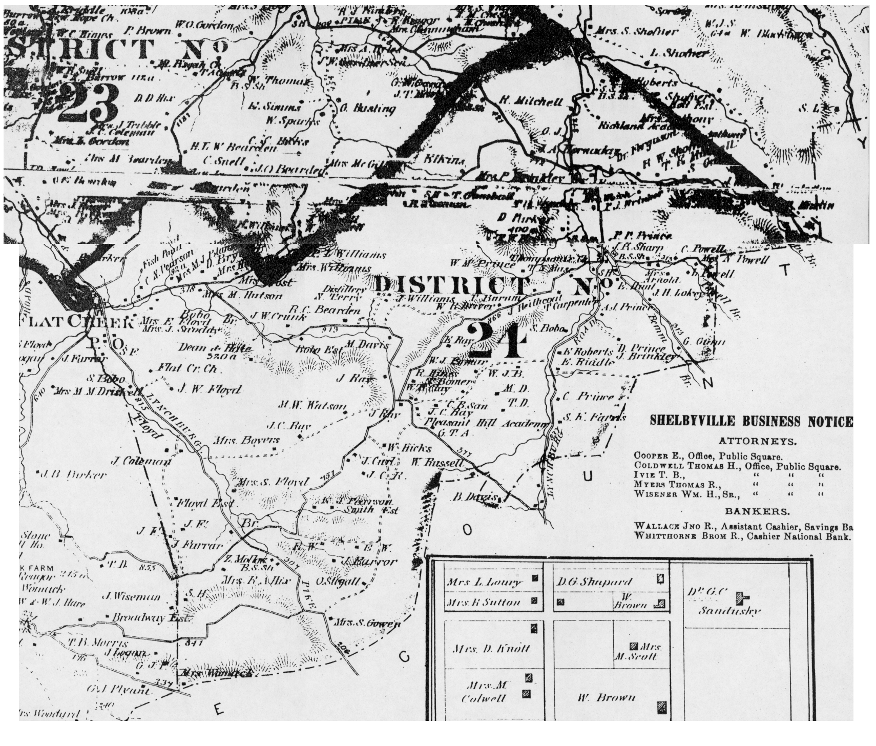
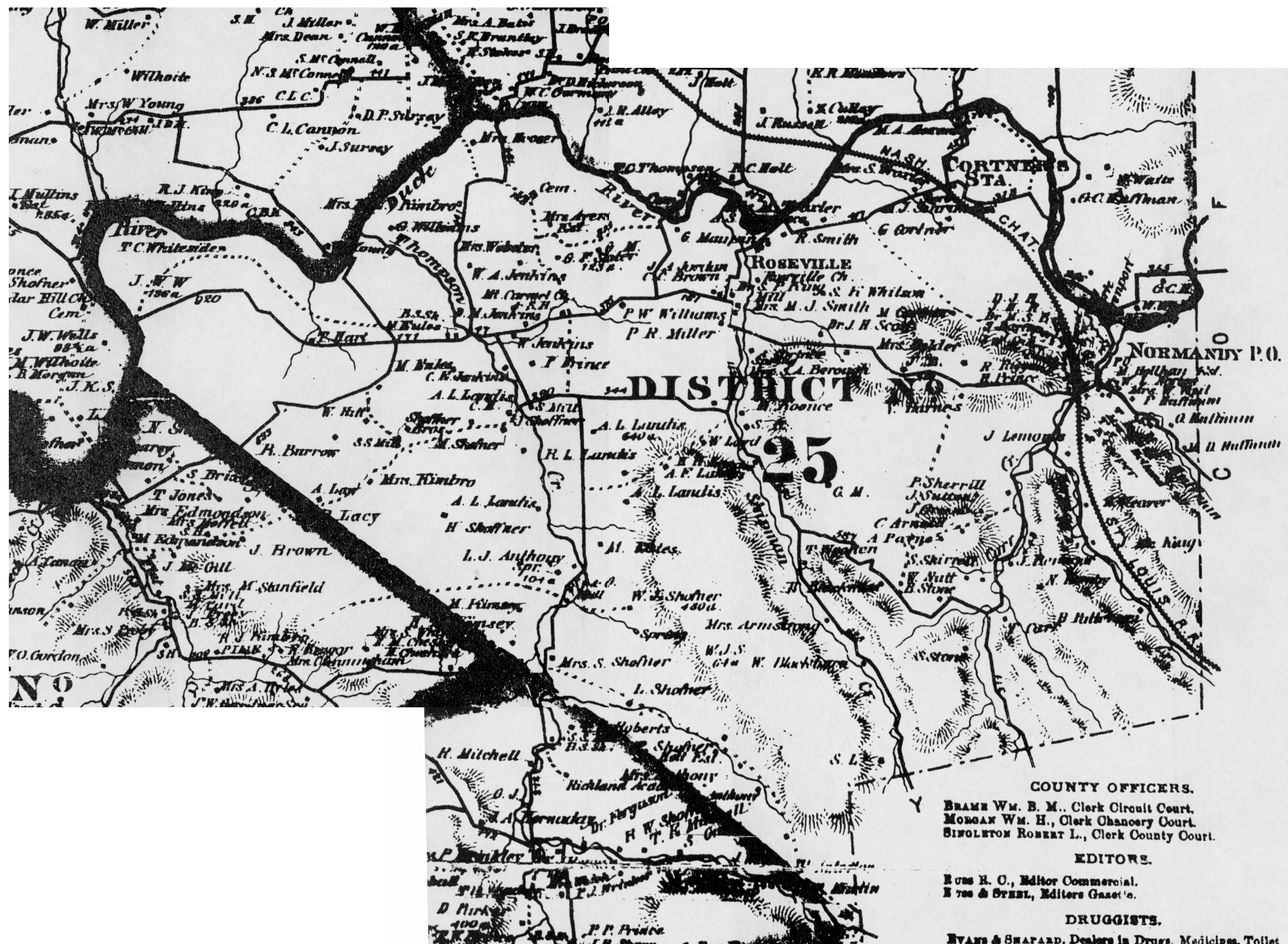
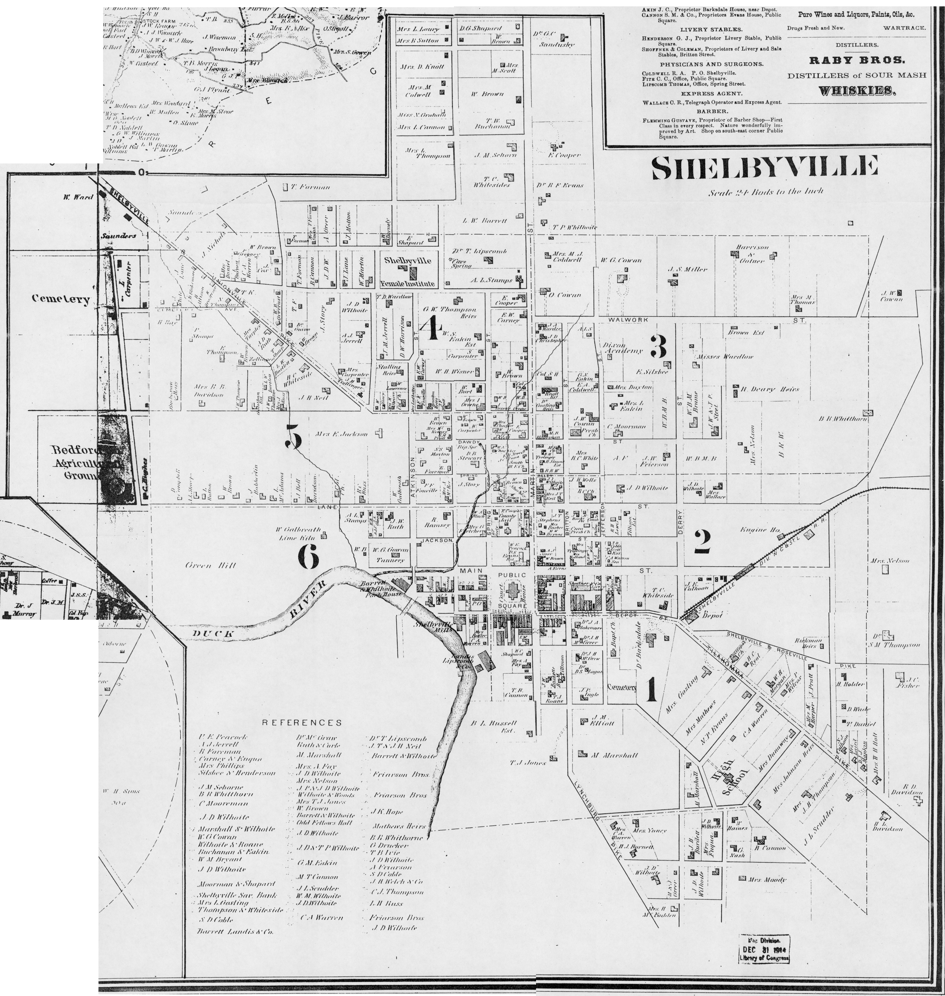
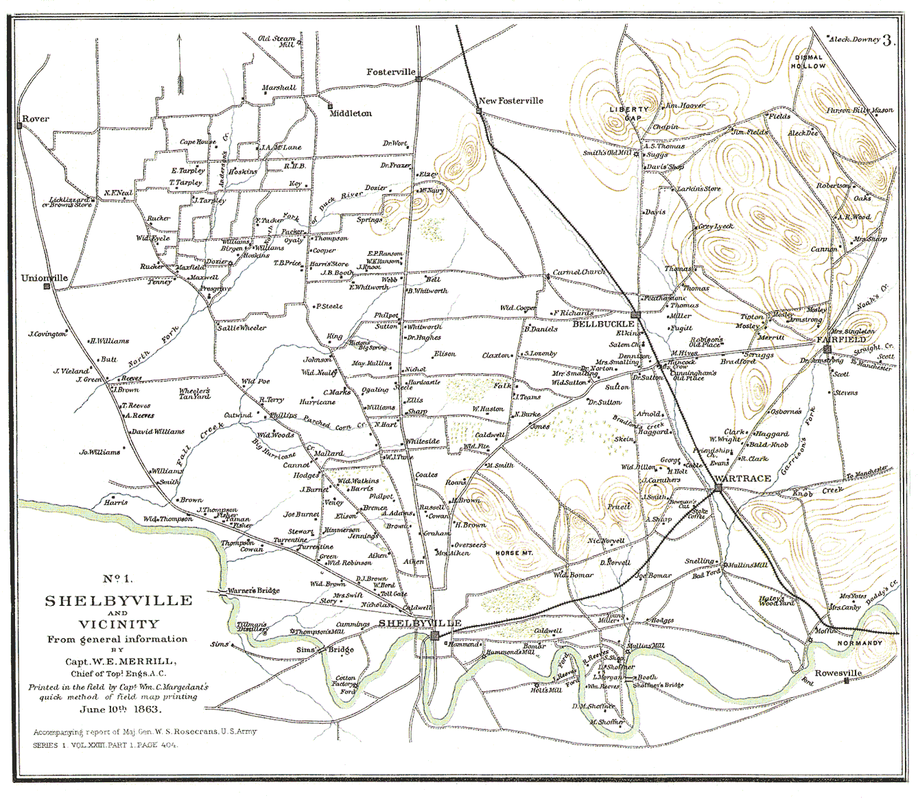
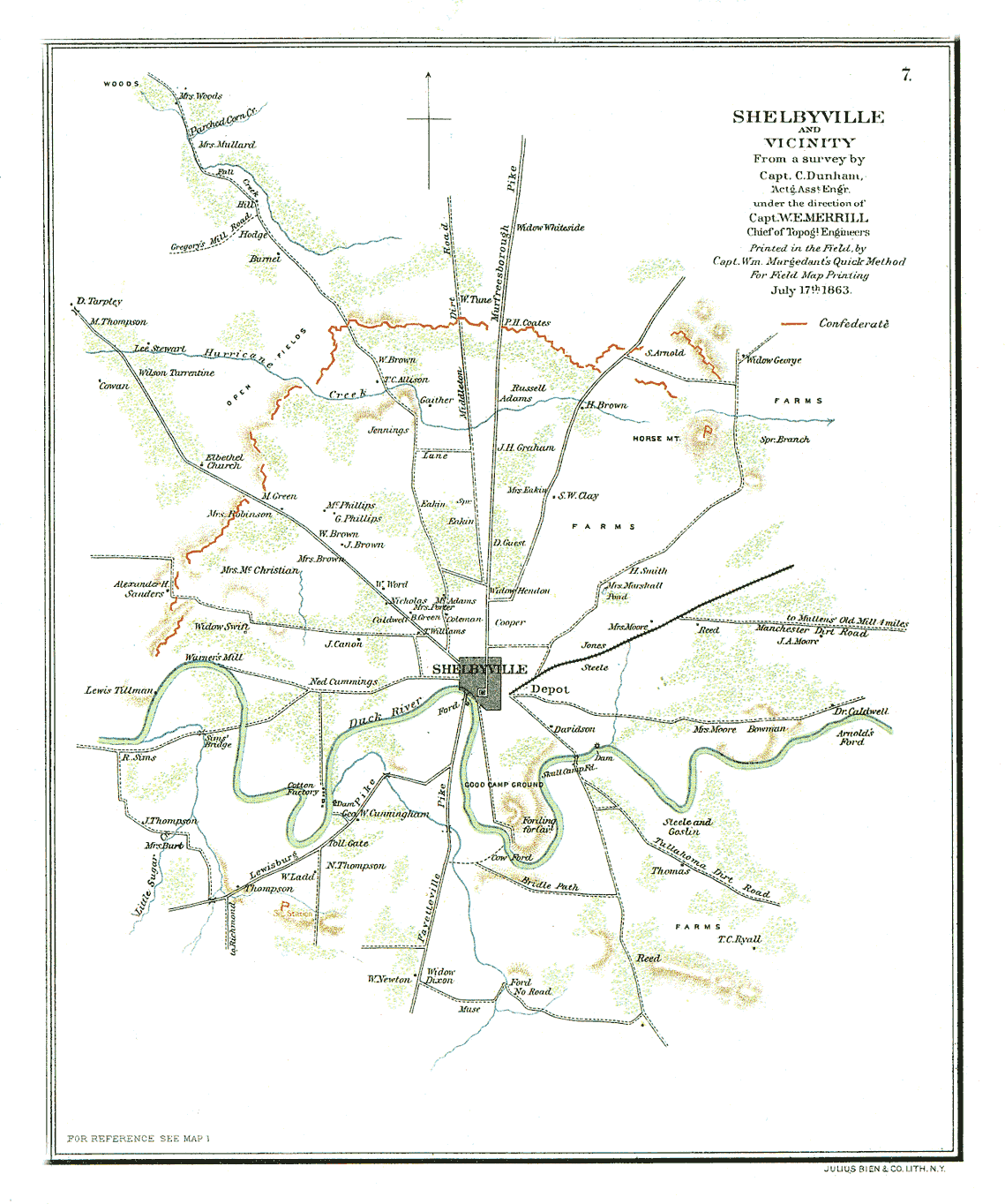
Two maps of Shelbyville and the vicinity from The Official Military Atlas of the Civil War by Maj. George B. Davis, Leslie J. Perry, and Joseph W. Kirkley.
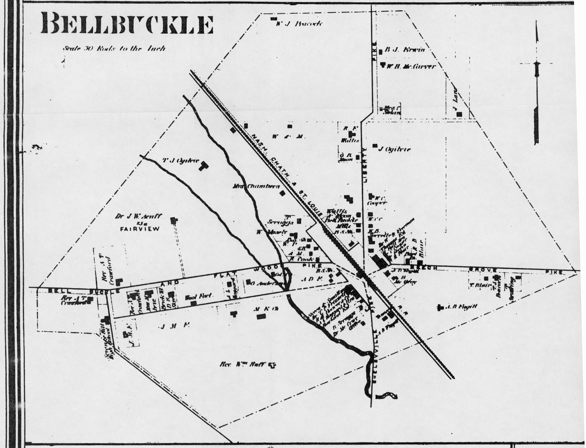
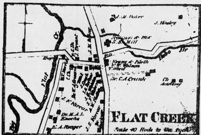
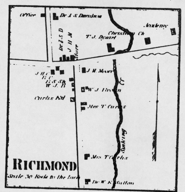
These maps are fairly large on-screen so they are readable. If printed copies of either maps are wanted, send $6 for each copy desired plus $4 s/h to the address below.
For printed coplies of any the maps above, send a check or money order to: Charles A. Reeves, Jr.; 10812 Dineen Drive; Knoxville, TN 37934-1809. They will be shipped rolled by Priority Mail.
Modern maps: Chamber of Commerce, 100 N. Cannon Blvd., Shelbyville, TN 37160; phone (615) 684-3482.
To find cemeteries, roads, towns, creeks, etc: Use the USGS GNIS Server
For searches in Tennessee, enter the name of the Feature you are looking for and select Tennessee from the pop-down list. You can narrow the search by entering Bedford in the county name field, but this search won't turn up any listings outside the county. If you're not sure of the county, leave this field blank. You can also try alternative spellings, or searches on just part of the name. A good example: If you are looking for something called "canebreak," just enter "cane" (w/o the quotes). You will get a fairly long list, but at the bottom you will see listings for "canebrake." In this case, the initial spelling was incorrect and would not have returned any (or incorrect) listings.
In the listing that comes up, you can click on the underlined names to pull up more detailed infromation, including a map of the location of the landmark.
Click here for a topo map of Bedford County, centered on Shelbyville.
Information on routes our ancestors followed when emigrating into the state is available here.
Return to Bedford County TN Gen Main Page
