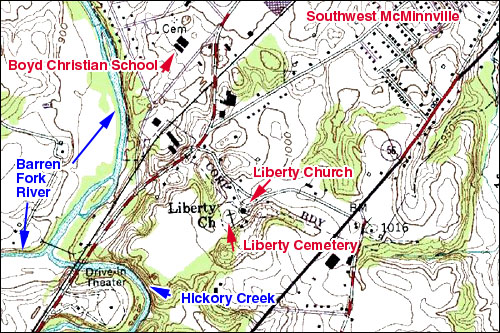
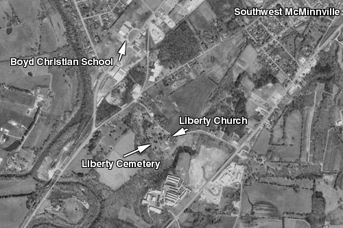
On the map below, the western red and white road is old Manchester Hwy. Eastern short red and white is 108 to Viola. Middle black is Hwy 55 to Morrison and Manchester and I-24. In front of the church and cemetery is Liberty Lane going from Hwy 55 to the Old Manchester Hwy on this map. The waterway is Barren Fork and Hickory Creek runs into it. I grew up in Westwood. Campbell Smoot, Jr. and I rode our horses all over in here and over to Liberty Lane to Mr. Rankins’ home which is the one with the semi-circular driveway below. I never remember a cemetery or stones where that CEM is written in. Down where the water way forks is a swinging bridge and the black dot west of the swinging bridge was the home of Cowan Oldham, friend of Estes Kefauver who used to spend time there in the summers. It was called Shangri-La. The white road circling off to the west of the red and white is a relatively new highway. The black bars below CEM are Boyd Christian School which shows up well in the aerial photo image below with semi-circular drive. That “CEM” is no longer a cemetery. There were three graves there and when the school was built they were removed to Old City Cemetery.
Notes:
Gravemarker readings for Liberty Cemetery may be found in: Warren County, Tennessee Cemetery Book 2. by Mrs. Almetia Cunningham and Mrs. Martha Holt, compiled and edited by Mrs. Betty M. Majors, 1993
Additional information on Liberty Cemetery and other Warren County cemeteries can be seen here. Use your back button to return.
Topo Map: Detail from USGS Centertown Quadrangle Tennessee 7.5 Series
Aerial Map: USGS Latitude/Longitude (Degrees, minutes, seconds):
35° 39' 38" N, 85° 47' 38"W