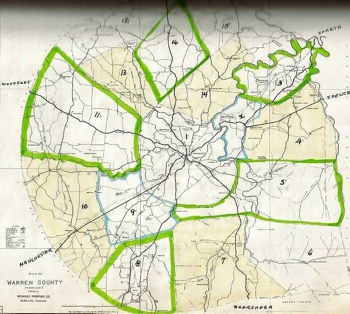
Warren County Districts, ca. 1950
This is a modern map of Warren County and is presented with permission to show researchers the approximate civil districts, topographical features such as streams, mountains and the county outline. District lines have been changed many times, but the districts appear much as at the time of the 1850 census.
Pingback:Records & Resources – Warren County, Tennessee, Genealogy & History