Available for copying at the Sumner County Archives and the Tennessee State Library and Archives
© September 1999
 |
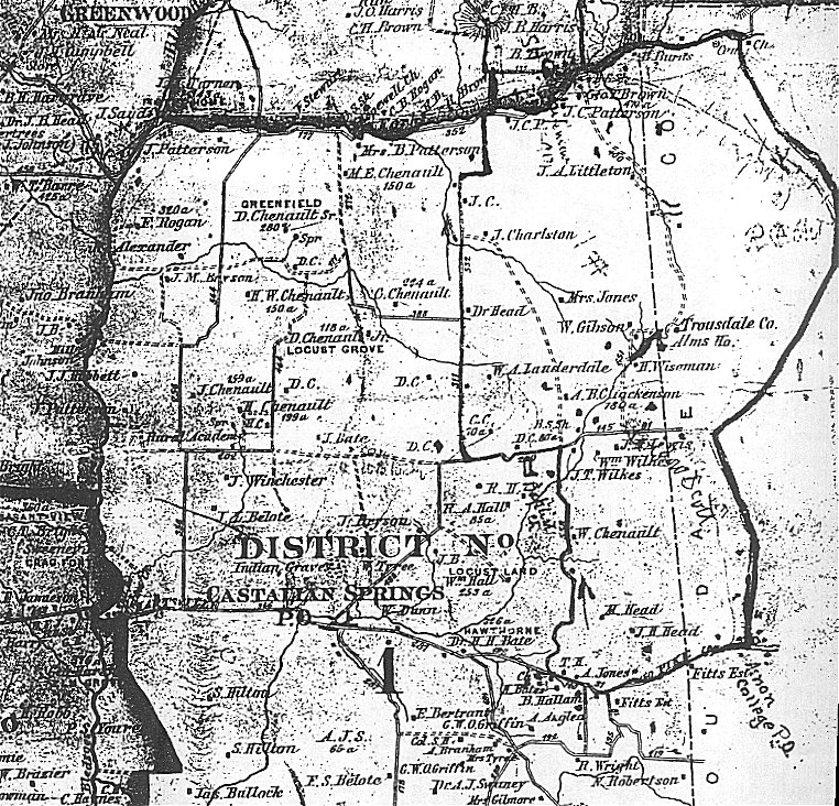
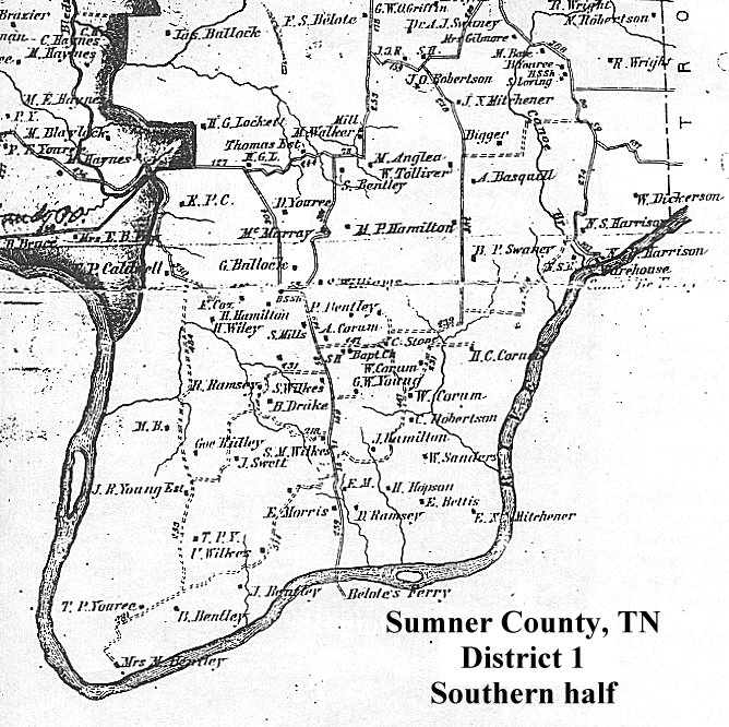
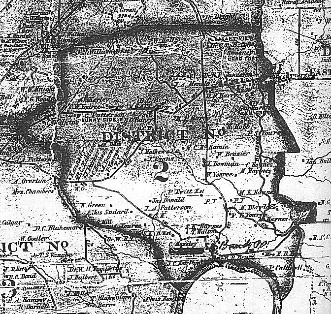
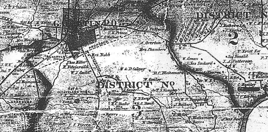
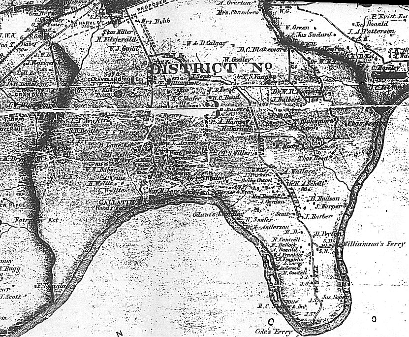
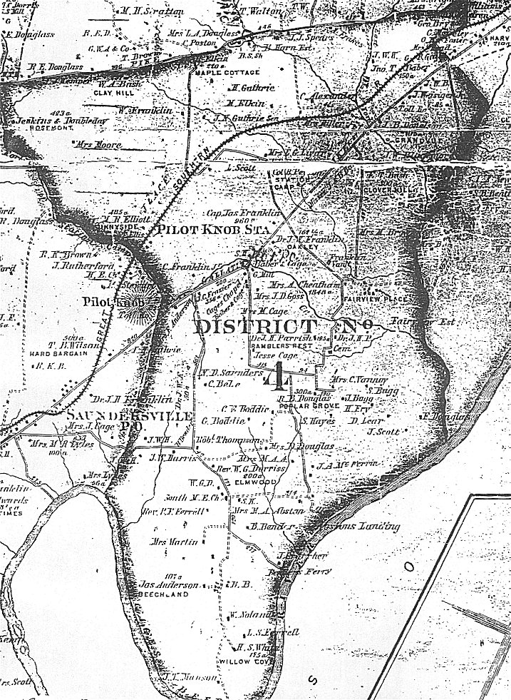
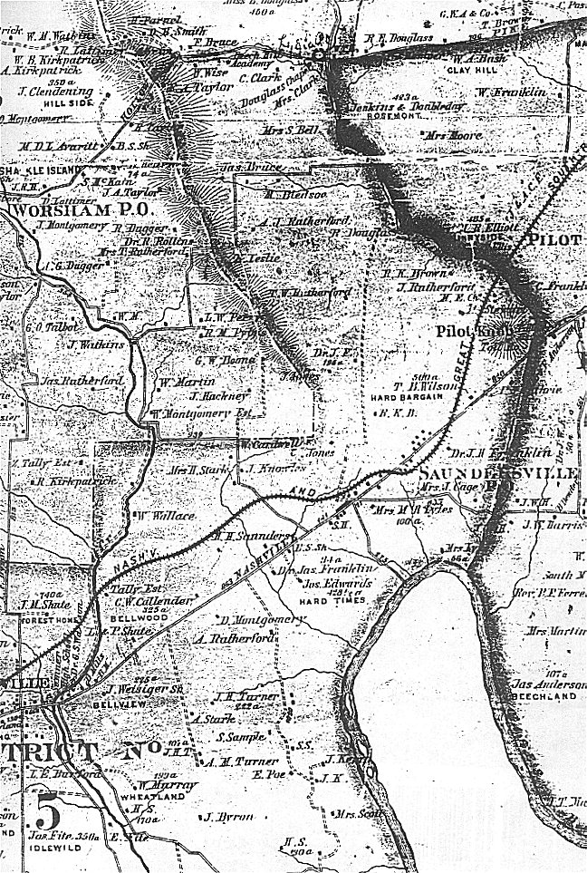
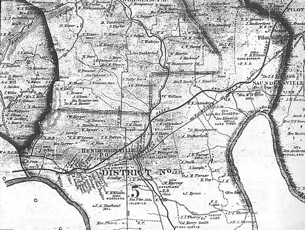
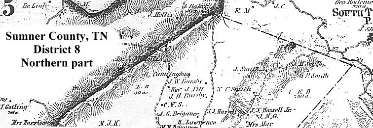
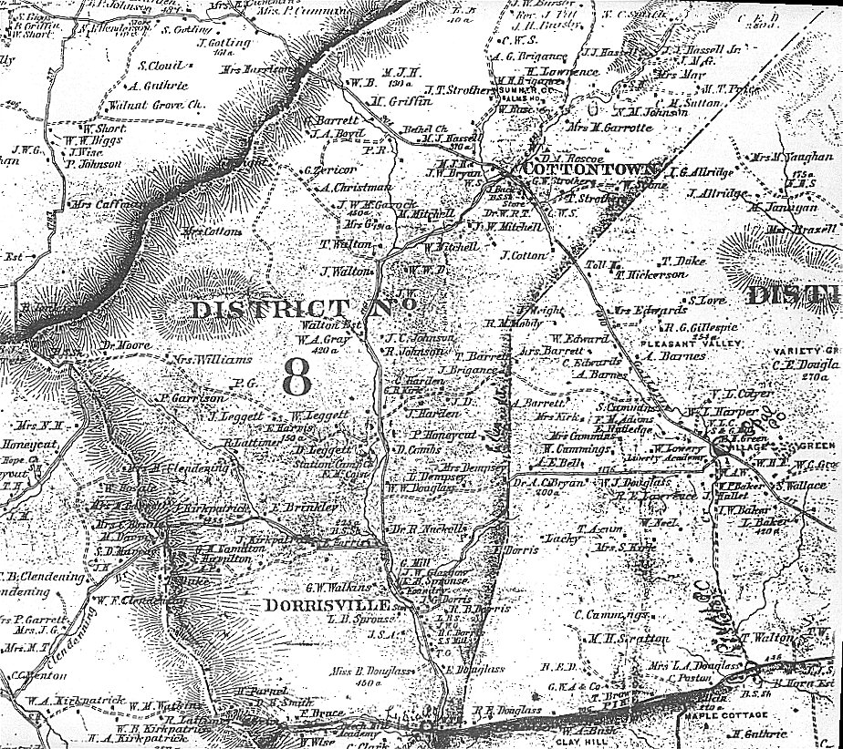
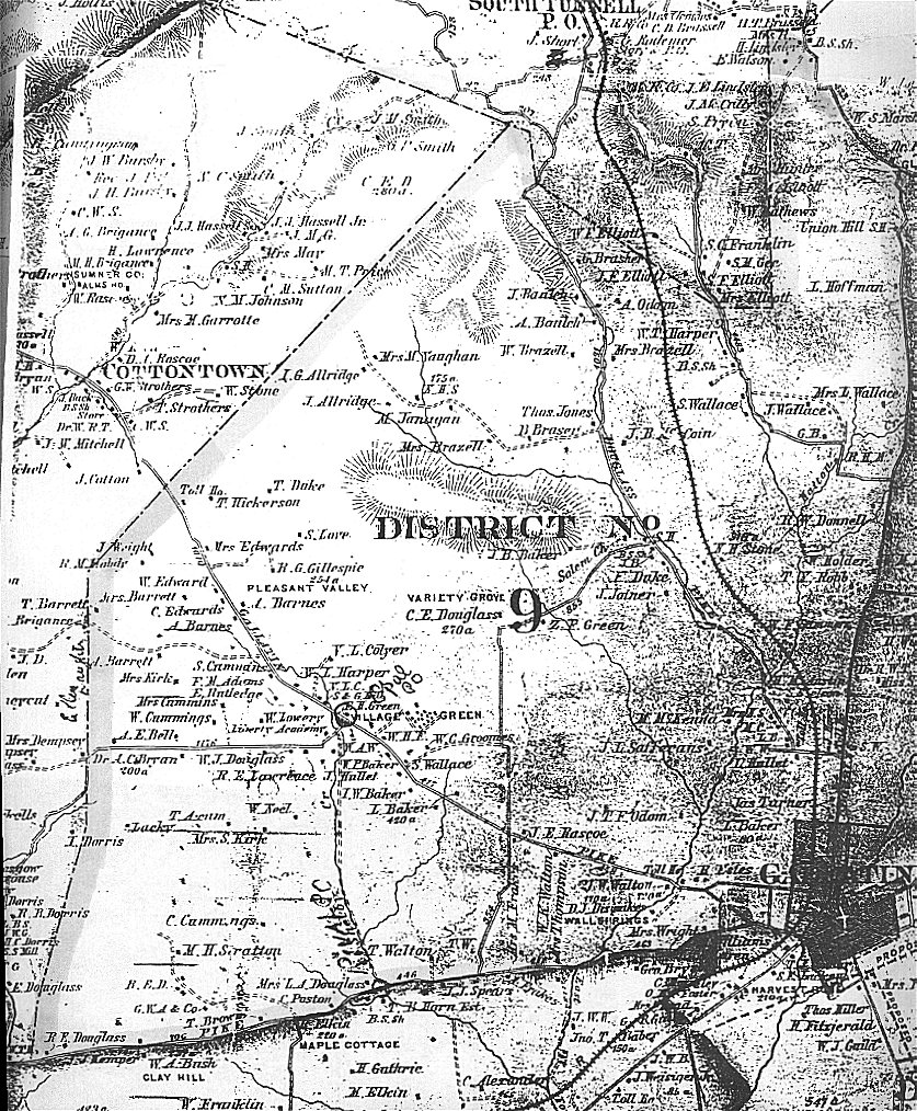
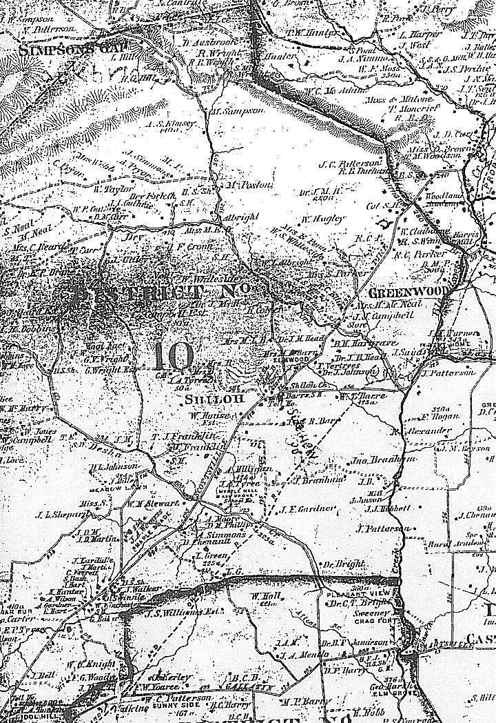
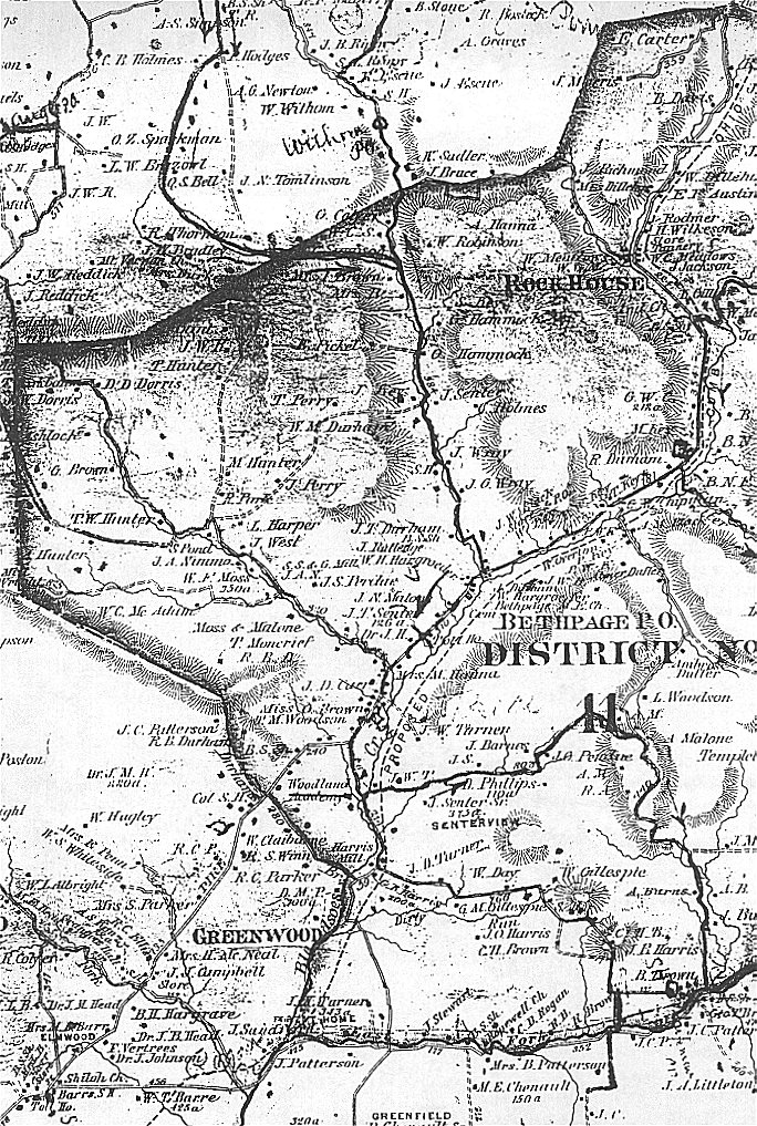
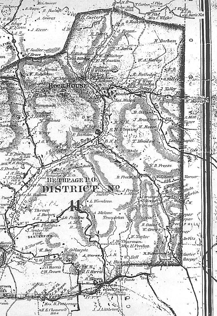
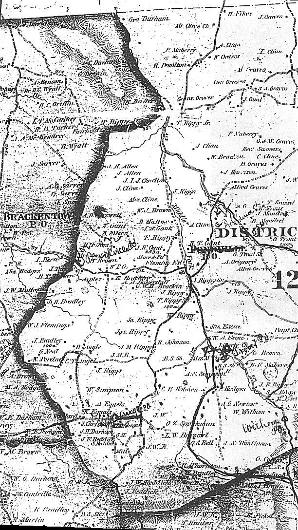
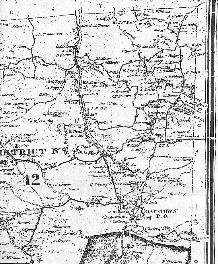
The map drawn in 1878 of Sumner County, TN is very large. I do not know the exact dimensions, but guess it is probably close to 4' x 6' in size. The map contains much useful information about Sumner County in 1878, including names and locations of land owners, names and locations of places of business, and population information. There are numerous small inset maps showing town residents and businesses. I have done the best we can to convey this information on Sumner County TNGenWeb page.
The maps have been scanned in small screen-size views. The names, place names, and businesses have been transcribed. We hope you find this information helpful.
- The first section below allows you to search alphabetically for a specific name. The
alphabetic tables will give you the district or town where the landowner resides. You may then
view the map(s) and locate the person for whom you are searching.
- The second section allows you to search alphabetically for a place name or business found on
the map. Those tables, too, give you the district of town where the place or business can be
found.
- The third section provides alphabetic listings of names and places for each district.
- The fourth section provides alphabetic listings of names and places for the towns found on the
map.
- The fifth section allows you to view additional business-related information found on the
Sumner County map.
- And, finally, the last section allows you to select JPEG views (graphic views) of the map. Remember, you MUST use your BACK key to return to the Sumner page after viewing the maps. Access to the maps is also found on the District and Town pages.
- Business Listings by Occupation from 1878 Sumner
County
Map - (does not include all individuals from alphabetical listing below)
- Business Notices for Surnames A-J from 1878 Sumner County Map
- Business Notices for Surnames K-Z from 1878 Sumner County Map
Maps (JPEGs)
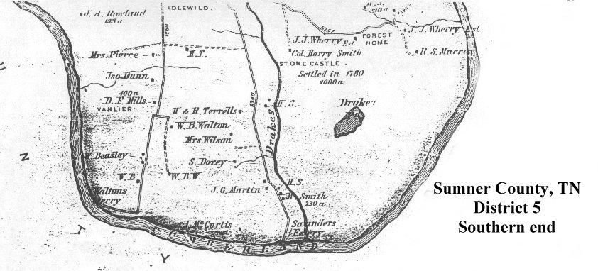
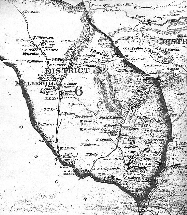
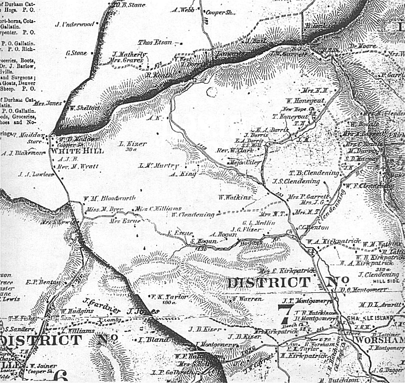
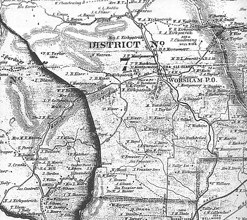
The 1878 Sumner County, TN map is laid out in 16 districts. They generally appear as shown below. This representation is NOT to scale! (There are many limits to what you can do with a table in HTML!) Because of the size of the map, I had to do multiple scans to get all of the single district.
The links to the scanned files are listed below. Remember, you MUST use your BACK key to return to this page.
| District 16 | District 13 | District 12 | |||
| District 15 | District 14 | ||||
| District 7 | District 10 | District 11 | |||
| District 6 | District 8 | District 9 | |||
| District 5 | District 4 | District 3 | District 2 | District 1 | |
- District 1, northern part
- District 1, southern part
- District 2
- District 3, northern part
- District 3, southern part
- District 4
- District 5, northern part
- District 5, middle part
- District 5, southern part
- District 6
- District 7, northern part
- District 7, southern part
- District 8, northern part
- District 8, southern part
- District 9
- District10, western part
- District 10, eastern part
- District 11, western part
- District 11, eastern part
- District 12, western part
- District 12, eastern part
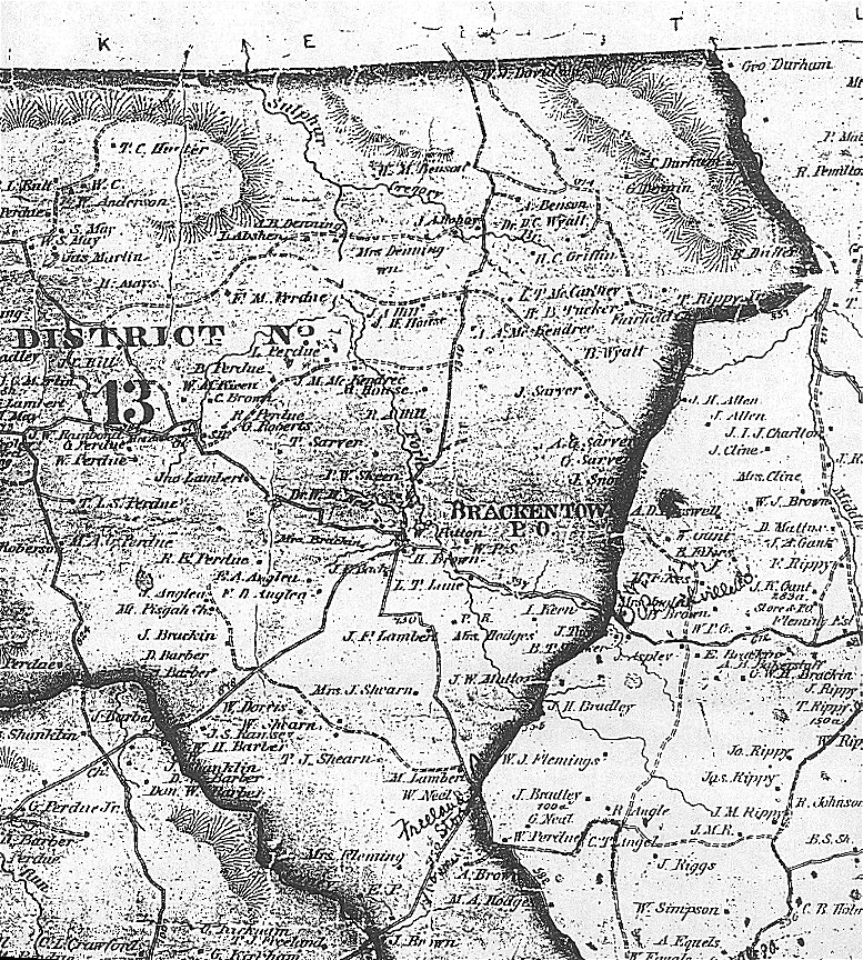
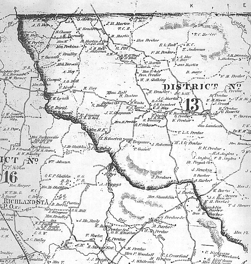
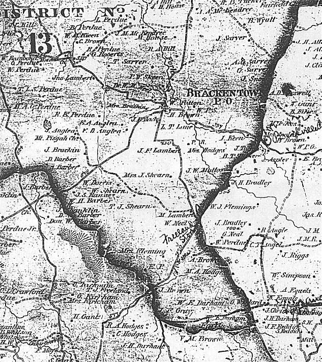
- District 13, eastern part
- District 13, western part
- District 13, southern part
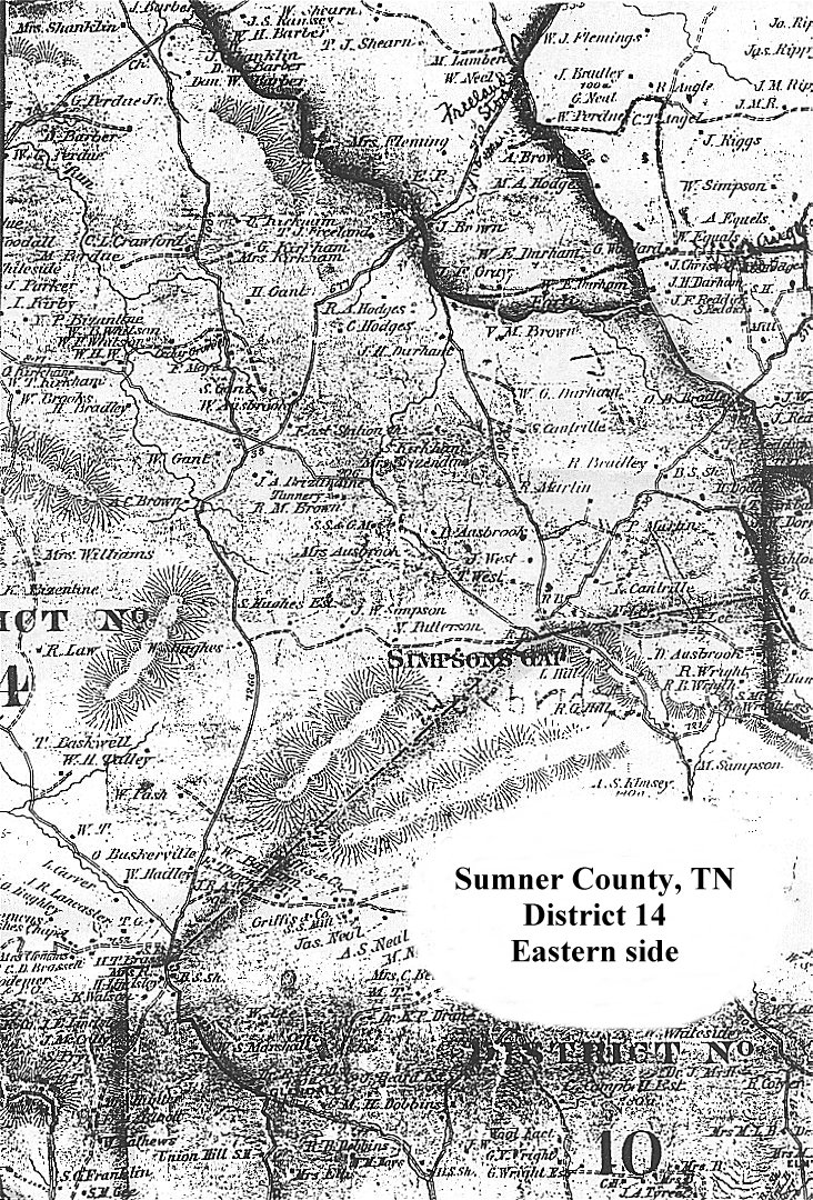
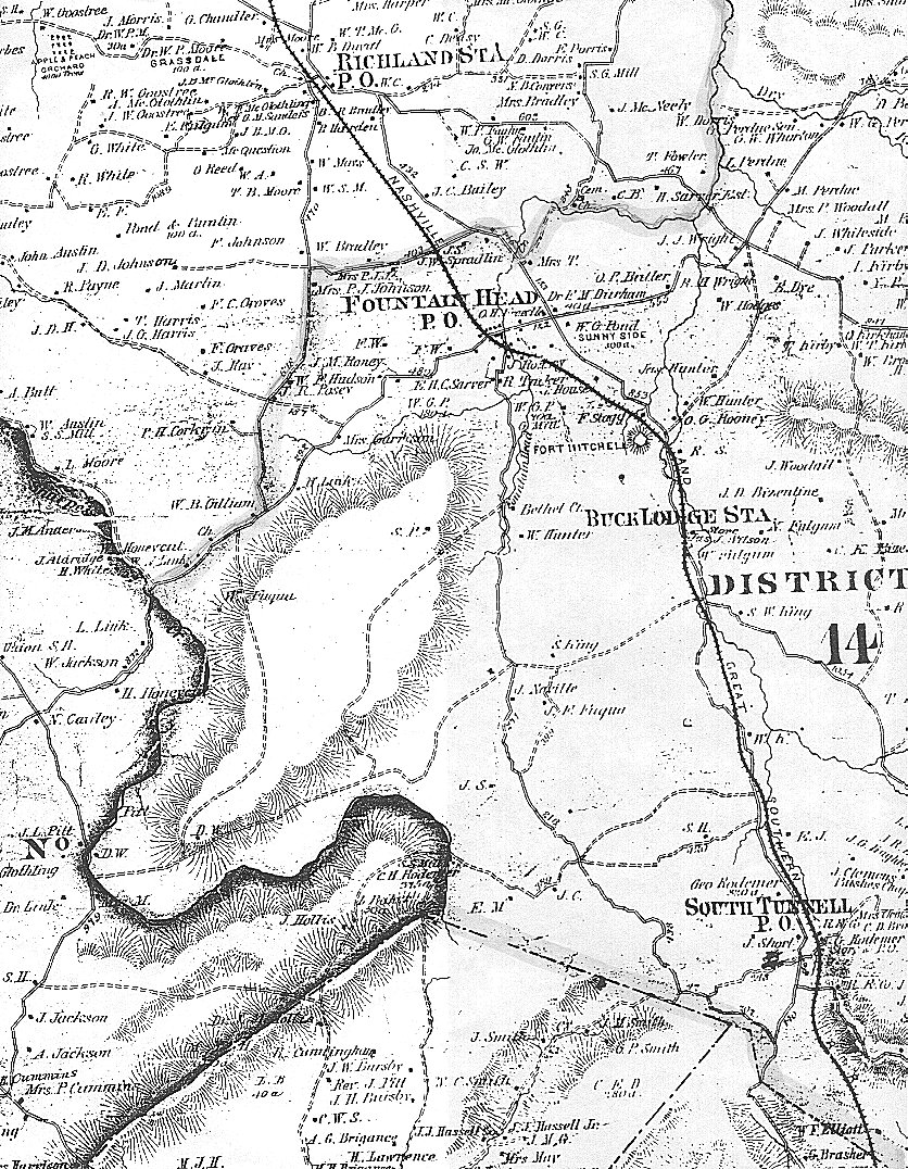
- District 14, eastern part
- District 14, western part
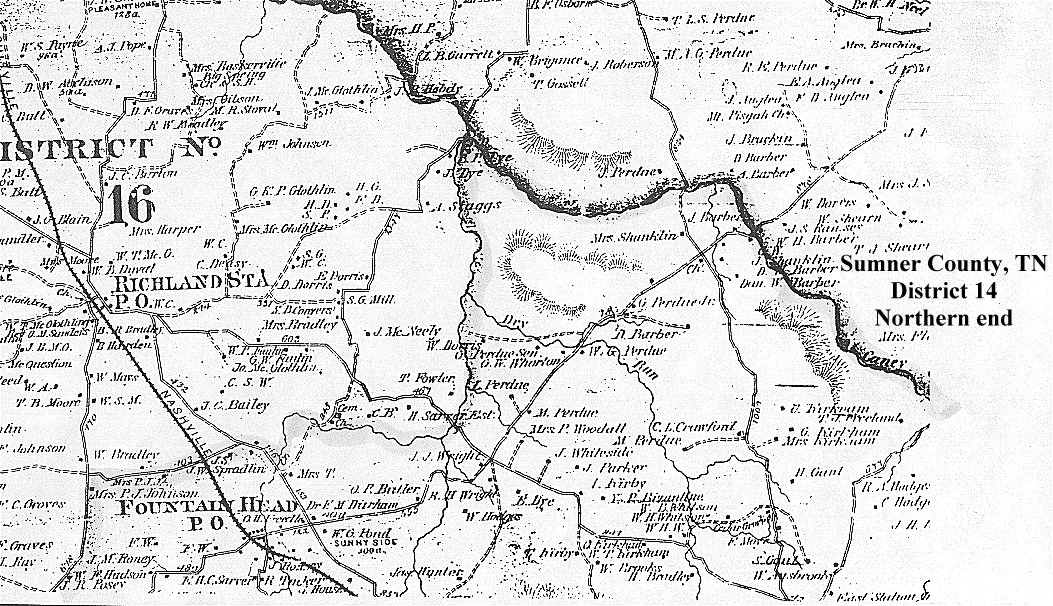
- District 14, northern part
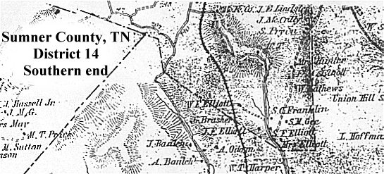
- District 14, southern part
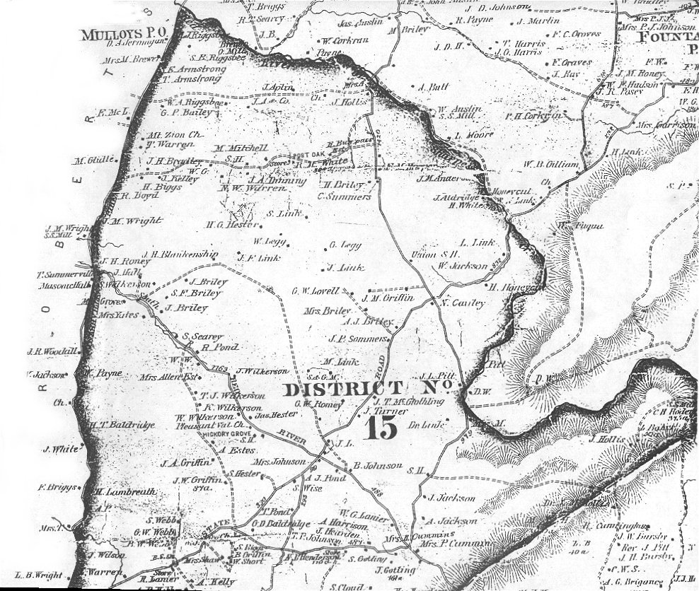
- District 15, northern part
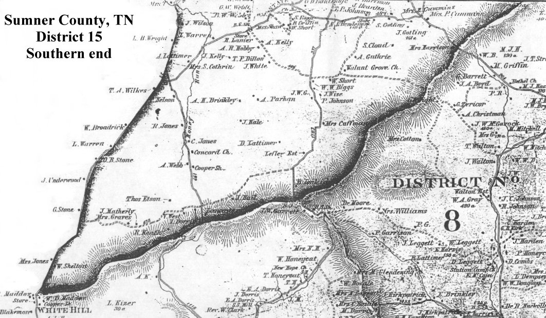
- District 15, southern part
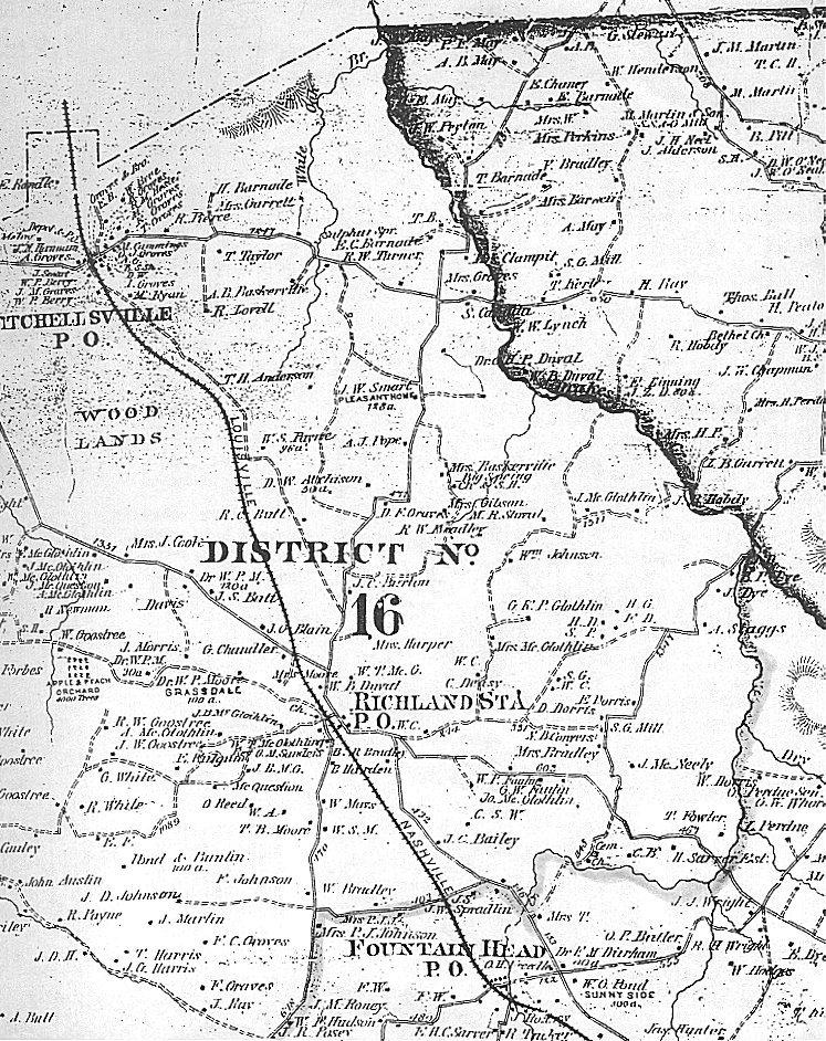
- District 16, eastern part
- District 16, western part
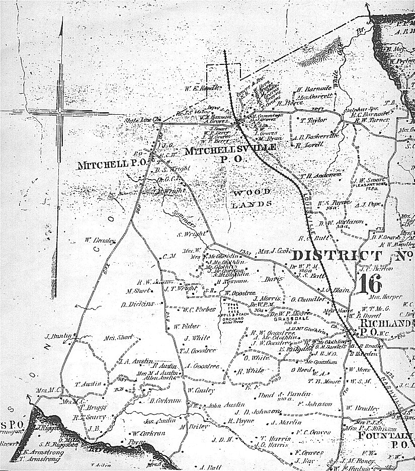
- District 16, southern part
Return to Sumner County Main Page
 |