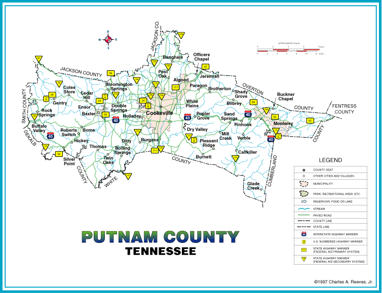
The county seat of Putnam County, Cookeville, is approximately eighty miles east of Nashville. Its irregular boundaries make it one of Tennessee's oddest shaped counties. After a number of boundary changes in the nineteenth century, on a map it resembles somewhat a Scottish terrier with a hump on its back. Extending about forty miles from east to west and fourteen miles from north to south, it has a total land area of 259,840 acres or 406 square miles.
Two versions of a small map of the current layout of the county are available on-line at the links below. The GIF image is viewable on-line, but is of limited resolution. The PDF version is much higher resolution but must be downloaded, and a copy of Adobe Acrobat Reader is required to view it. For more information about Acrobat files, see the page at this link. Also, as noted below, the PDF version is over 1.8 MB in size, so it will take awhile to download.
View the GIF image of a map of Putnam County.
PDF Download a copy of the PDF file of a map of Putnam County. (1.8 MB!)
A page showing the coverage of Putnam County by the USGS 1:24,000 (7.5 minute) topographical maps is also available, although these maps are somewhat dated. One, the Dodson Branch map, hasn't been updated since 1968. The last one updated, Campbell Junction, was updated in 1986. Ordering information for these maps is included.
View the coverage of Putnam County by the USGS maps.
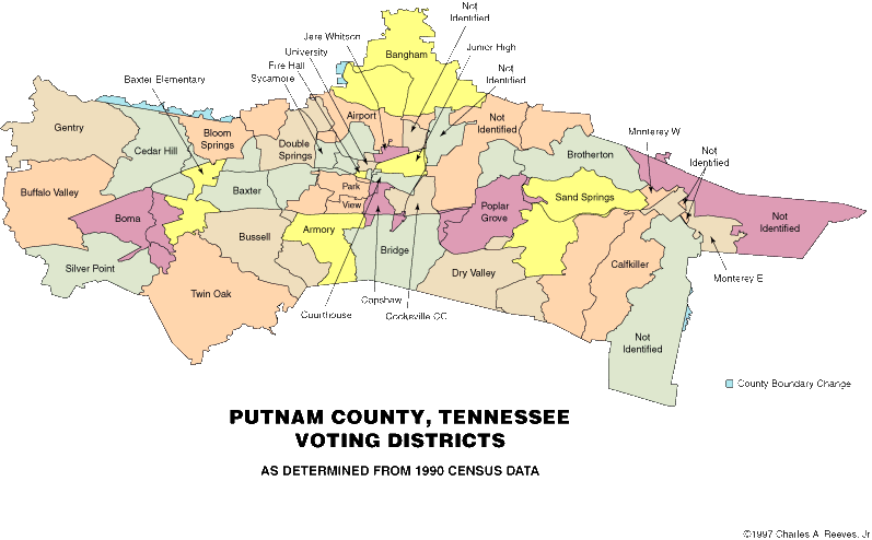
Maps are also available showing the voting districts and congressional districts of Putnam County as of the last U.S. census (1990).
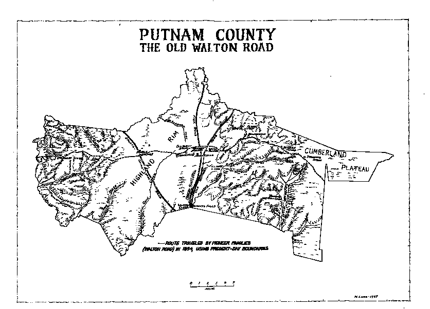
The Old Walton Road - Putnam County initially rose to prominence because one of the major east-west thoroughfares for those making the trek West in the 1800s, the Old Walton Road, crossed the county. This road was completed under the supervision of William Walton of Carthage in 1802 and connected Kingston in eastern Tennessee at the junction of the Clinch and Tennessee rivers (Southwest Point) with the junction of the Caney Fork and Cumberland Rivers at Carthage. Today's U.S. Highway 70N follows roughly the same route in spots. The road thus linked Tennessee's two principal river systems, the major "highways" of commerce at the time, and greatly facilitated travel and commerce between East and Middle Tennessee. The Cumberland Turnpike Company operated the Road as a toll road from 1802 to 1811 under charter from the Tennessee General Assembly, but the State resumed control of the road in 1811. However, the Assembly still granted individuals the right to operate portions of the Road and to charge tolls to cover maintenance. As a result of this practice and the opening of the Sparta Turnpike in its paved form in 1828, the Walton Road declined and some portions fell into disrepair.
Two versions of a map showing The Old Walton Road and other landmarks of the era are available on-line at the links below. The GIF image is viewable on-line, but is of limited resolution. The PDF version is much higher resolution but must be downloaded, and a copy of Adobe Acrobat Reader is required to view it. For more information about Acrobat files, see the page at this link. Also, as noted, the PDF file is 1 MB, so it may take awhile to download.
View the low resolution image on-line.
Download the PDF version. (1 MB!)
Note: Portions of this section are from: Putnam County, Tennessee, 1850-1970, by Mary Jean DeLozier (Leon and Mary Jean DeLozier; Box 386; Cookeville, TN 38501; 1979; ISBN 0-9604900). Used with permission.
Return to the Putnam County Web page.